
IMAGES TAKEN NEAR TO
St. Johns Green, WALLINGFORD, OX10 9AB
Introduction
This page details the photographs taken nearby to St. Johns Green, OX10 9AB by members of the Geograph project.
The Geograph project started in 2005 with the aim of publishing, organising and preserving representative images for every square kilometre of Great Britain, Ireland and the Isle of Man.

There are currently over 7.5m images from over14,400 individuals and you can help contribute to the project by visiting https://www.geograph.org.uk
Image Map
Images are licensed for reuse under creativecommons.org/licenses/by-sa/2.0
Notes
- Clicking on the map will re-center to the selected point.
- The higher the marker number, the further away the image location is from the centre of the postcode.
Image Listing (704 Images Found)
Images are licensed for reuse under creativecommons.org/licenses/by-sa/2.0
Image
Details
Distance
1
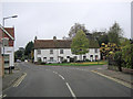
End of St Mary's Street
This is a crossroads. St Mary's Street is one-way, heading south, and transitions into Reading Road. To the left is Lower Wharf and the River Thames, whilst the white cottages centre picture front onto St John's Road but have Squires Walk on their right.
Image: © Stuart Logan
Taken: 11 Nov 2011
0.02 miles
2
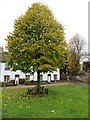
Tree on the Green
A young tree planted a few years ago to replace the old one there that was cut down on St Johns Green Wallingford
Image: © Bill Nicholls
Taken: 17 Nov 2013
0.02 miles
3
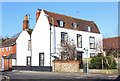
St John's Road
Junction of St John's Road and Lower Wharf.
Image: © Wayland Smith
Taken: 16 Feb 2014
0.02 miles
4

Mill stream
This was the mill stream that ran through Wallingford, now it's dried up and full of weeds
Image: © Bill Nicholls
Taken: 17 Dec 2025
0.02 miles
5

Blocked stream
A shed m waterbutt and lots of vegetation are only some of the items that stop water running along the old mill stream in Wallingford
Image: © Bill Nicholls
Taken: 17 Dec 2025
0.02 miles
6
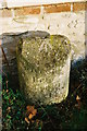
Milestone outside Angiers Almshouses, Wallingford
Milestone with Ordnance Survey pivot benchmark (arrow pointing to square recess on top of the stone) presently against the wall of Angiers Almshouses, Reading Road, Wallingford. The weathered inscription reads 'Oxford 13 Reading 15'. For more information see http://www.bench-marks.org.uk/bm30421
Image: © Roger Templeman
Taken: 26 Feb 2010
0.03 miles
7
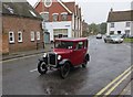
Seven driving by
An Austin Seven drives into Wallingford on a drizzly day.
Image: © Bill Nicholls
Taken: 17 Nov 2013
0.03 miles
8
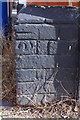
Benchmark on Ptolomy House, Reading Road
Ordnance Survey cut mark benchmark described on the Bench Mark Database at http://www.bench-marks.org.uk/bm23362
Image: © Roger Templeman
Taken: 21 Feb 2014
0.03 miles
9
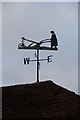
Ploughman weather vane
First time I noticed this weather vane on the old Wilders building was the other day, I think it pretty well confirms what the place used to be, an outlet for farm machinery.
Image: © Bill Nicholls
Taken: 11 Dec 2010
0.03 miles
10

Manhole in the stream bed
I have to wonder why ths is here in the old Mill stream in Wallingford
Image: © Bill Nicholls
Taken: 17 Dec 2025
0.03 miles