
IMAGES TAKEN NEAR TO
Mongewell, WALLINGFORD, OX10 8DD
Introduction
This page details the photographs taken nearby to OX10 8DD by members of the Geograph project.
The Geograph project started in 2005 with the aim of publishing, organising and preserving representative images for every square kilometre of Great Britain, Ireland and the Isle of Man.

There are currently over 7.5m images from over14,400 individuals and you can help contribute to the project by visiting https://www.geograph.org.uk
Image Map
Images are licensed for reuse under creativecommons.org/licenses/by-sa/2.0
Notes
- Clicking on the map will re-center to the selected point.
- The higher the marker number, the further away the image location is from the centre of the postcode.
Image Listing (66 Images Found)
Images are licensed for reuse under creativecommons.org/licenses/by-sa/2.0
Image
Details
Distance
1

College Buildings
Looking down the farm land at some of the college buildings.
Image: © Bill Nicholls
Taken: 13 Apr 2008
0.07 miles
3

Farmland, Crowmarsh
A crop of barley at Mongewell Park with the Wittenham Clumps in the distance.
Image: © Andrew Smith
Taken: 19 Jun 2009
0.10 miles
4
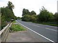
The A4130 Wallingford bypass
Heading for the Mongewell roundabout.
Image: © David Purchase
Taken: 4 Oct 2015
0.11 miles
5
Nosworthy Way nearing entrance to CABI publishing
Image: © John Firth
Taken: 20 Sep 2013
0.11 miles
6
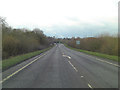
A4130 passes entrance to C A B I
C A B I = International Agricultural Information centre on the map.
Image: © Stuart Logan
Taken: 8 Feb 2013
0.12 miles
7

Road past CABI
The Wallingford bypass where it bends round past CABI and on to the Mongewell roundabout
Image: © Bill Nicholls
Taken: 8 Jun 2008
0.13 miles
8
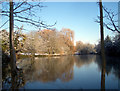
Mongewell Lake
This spring fed lake is the source of a very short Thames tributary. From the far end of the lake to confluence with the river can't be more than 600 metres, but in that short distance it takes in two lakes, a couple of waterfalls and a boathouse.
Image: © Des Blenkinsopp
Taken: 6 Jan 2010
0.13 miles
9
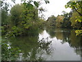
The Lake, Mongewell
Passed by the Ridgeway National Trail on its journey through Mongewell Park.
Image: © Chris Heaton
Taken: 2 Oct 2007
0.15 miles
