IMAGES TAKEN NEAR TO
Ewelme, WALLINGFORD, OX10 6QA
Introduction
This page details the photographs taken nearby to OX10 6QA by members of the Geograph project.
The Geograph project started in 2005 with the aim of publishing, organising and preserving representative images for every square kilometre of Great Britain, Ireland and the Isle of Man.

There are currently over 7.5m images from over14,400 individuals and you can help contribute to the project by visiting https://www.geograph.org.uk
Image Map
Images are licensed for reuse under creativecommons.org/licenses/by-sa/2.0
Notes
- Clicking on the map will re-center to the selected point.
- The higher the marker number, the further away the image location is from the centre of the postcode.
Image Listing (18 Images Found)
Images are licensed for reuse under creativecommons.org/licenses/by-sa/2.0
Image
Details
Distance
1

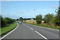
The Airfield Bypass
The A4170 bears East from the North Easterly heading London Road, built to avoid the World War II aerodrome at Benson.
Image: © Colin Bates
Taken: 7 Sep 2005
0.02 miles
2
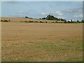
A view North East
A view North East, looking towards Harcourt Hill, the old London Road is hidden by the
field boundary.
Image: © Colin Bates
Taken: 7 Sep 2005
0.02 miles
3

Avenue from May's Farm towards the A4130
Image: © Roger Templeman
Taken: 3 Apr 2017
0.05 miles
4
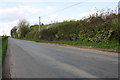
Old London Road near May's Farm Cottages
There used to be a milestone on the verge on the right hand side of the road here: it indicated Oxford 15 Henley 8, see http://www.bench-marks.org.uk/bm19829
Image: © Roger Templeman
Taken: 3 Apr 2017
0.06 miles
6

Footpath running NE from Old London Road
Image: © Roger Templeman
Taken: 3 Apr 2017
0.09 miles
7
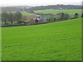
Farmland, Nuffield
Looking down from Harcourt Hill. The A4130 can be seen heading towards Wallingford.
Image: © Andrew Smith
Taken: 26 Jan 2008
0.10 miles
8

Restricted byway near Ewelme
A route heading towards Nuffield on Harcourt Hill.
Image: © Andrew Smith
Taken: 7 Dec 2008
0.15 miles
9

Footpath down across the field
Footpath down across the field to the A4130
Image: © Shaun Ferguson
Taken: 20 Mar 2009
0.17 miles