
IMAGES TAKEN NEAR TO
Benson, WALLINGFORD, OX10 6PR
Introduction
This page details the photographs taken nearby to OX10 6PR by members of the Geograph project.
The Geograph project started in 2005 with the aim of publishing, organising and preserving representative images for every square kilometre of Great Britain, Ireland and the Isle of Man.

There are currently over 7.5m images from over14,400 individuals and you can help contribute to the project by visiting https://www.geograph.org.uk
Image Map
Images are licensed for reuse under creativecommons.org/licenses/by-sa/2.0
Notes
- Clicking on the map will re-center to the selected point.
- The higher the marker number, the further away the image location is from the centre of the postcode.
Image Listing (6 Images Found)
Images are licensed for reuse under creativecommons.org/licenses/by-sa/2.0
Image
Details
Distance
1
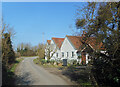
Blenheim Farm on the Icknield Way
The lane in front of the farmhouse is identified in antique script on the map as being the prehistoric Icknield Way. I guess there must be some evidence for that, somewhere, but it seems a hard sort of thing to prove.
Image: © Des Blenkinsopp
Taken: 1 Mar 2021
0.02 miles
2
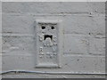
OS Flush Bracket G1787 - Blenheim Farm
OS Flush Bracket G1787 on Blenheim Farm
Image: © thejackrustles
Taken: 6 Oct 2019
0.03 miles
3
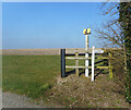
Pipeline Marker at Lonesome Farm
Beside the entrance to the farm.
Image: © Des Blenkinsopp
Taken: 1 Mar 2021
0.03 miles
4
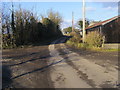
Swan's Way
Swan's Way on the lane passing Blenheim Farm
Image: © Shaun Ferguson
Taken: 10 Feb 2010
0.04 miles
6

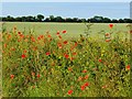
Farmland, Crowmarsh
Looking across fields of wheat and rape. The clouds rising from Didcot were the only ones in the sky at this stage in the day.
Image: © Andrew Smith
Taken: 15 Apr 2008
0.24 miles