
IMAGES TAKEN NEAR TO
Maple Furlong, OX10 6FP
Introduction
This page details the photographs taken nearby to Maple Furlong, OX10 6FP by members of the Geograph project.
The Geograph project started in 2005 with the aim of publishing, organising and preserving representative images for every square kilometre of Great Britain, Ireland and the Isle of Man.

There are currently over 7.5m images from over14,400 individuals and you can help contribute to the project by visiting https://www.geograph.org.uk
Image Map
Images are licensed for reuse under creativecommons.org/licenses/by-sa/2.0
Notes
- Clicking on the map will re-center to the selected point.
- The higher the marker number, the further away the image location is from the centre of the postcode.
Image Listing (13 Images Found)
Images are licensed for reuse under creativecommons.org/licenses/by-sa/2.0
Image
Details
Distance
1

Maple Furlong, Benson
Benson continues to grow rapidly. At this rate it won't be long before the 21st century bit of the village is larger than the original, if it isn't already.
Image: © Des Blenkinsopp
Taken: 14 Aug 2025
0.04 miles
2

Great Mead and Mile Stone Piece
Two new streets in the rapidly expanding housing developments on the north side of Benson.
Image: © Des Blenkinsopp
Taken: 14 Aug 2025
0.09 miles
3

Play Area, Benson Country Park
On the edge of the current development area on the north side of Benson.
In only a few years SU6192 has gone from being nearly all agricultural to getting on for 50% suburban.
Image: © Des Blenkinsopp
Taken: 14 Aug 2025
0.12 miles
4
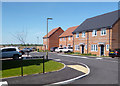
Cheneys Piece, Benson
Part of a large new housing development on the north side of Benson.
Image: © Des Blenkinsopp
Taken: 21 Apr 2020
0.14 miles
5

Benson Country Park
On the edge of an extensive new housing development on the north side of Benson, the Country Park is definitely a Work in Progress just now. It's got some paths, a notice and a couple of bins, but this year's drought has frazzled the grass and killed most of the new trees.
Given time, I'm sure it will mature into something more inviting.
Image: © Des Blenkinsopp
Taken: 14 Aug 2025
0.14 miles
6
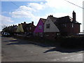
Port Hill Road, Benson
A short cul-de-sac off Hale Road.
Image: © Andrew Smith
Taken: 19 Mar 2006
0.17 miles
7
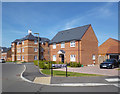
Bonners Mead, Benson
New housing on former farmland on the north west side of the village.
Image: © Des Blenkinsopp
Taken: 15 Apr 2020
0.19 miles
8

Sunnyside recreation ground
Sunnyside recreation ground by Hale road
Image: © Shaun Ferguson
Taken: 18 Oct 2008
0.21 miles
9
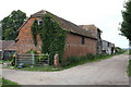
Benchmarked barn at Hale Farm
There is an OS benchmark Image at the junction of the short wall (to right of gate) and the ivy clad corner of the barn.
Image: © Roger Templeman
Taken: 2 Jun 2011
0.22 miles
10
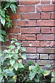
Benchmark on barn at Hale Farm
Ordnance Survey cut mark benchmark described on the Bench Mark Database at http://www.bench-marks.org.uk/bm38179
Image: © Roger Templeman
Taken: 2 Jun 2011
0.22 miles