IMAGES TAKEN NEAR TO
Benson, WALLINGFORD, OX10 6AA
Introduction
This page details the photographs taken nearby to OX10 6AA by members of the Geograph project.
The Geograph project started in 2005 with the aim of publishing, organising and preserving representative images for every square kilometre of Great Britain, Ireland and the Isle of Man.

There are currently over 7.5m images from over14,400 individuals and you can help contribute to the project by visiting https://www.geograph.org.uk
Image Map
Images are licensed for reuse under creativecommons.org/licenses/by-sa/2.0
Notes
- Clicking on the map will re-center to the selected point.
- The higher the marker number, the further away the image location is from the centre of the postcode.
Image Listing (7 Images Found)
Images are licensed for reuse under creativecommons.org/licenses/by-sa/2.0
Image
Details
Distance
1
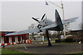
Spitfire gate guardian at RAF Benson
This is a replica of a Supermarine Spitfire PR Mk XI in the colours of 841 Squadron.
Image: © Roger Davies
Taken: 1 Jan 2016
0.01 miles
2
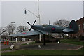
Main entrance to RAF Benson with replica Spitfire
Image: © Roger Davies
Taken: 1 Jan 2016
0.01 miles
3
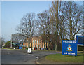
RAF Benson
The main entrance to the airfield, with the usual plane on a plinth in the background.
Are these all real old aircraft or models specially made?
Update from Mick Lobb : Gate guardian aircraft are often the real deal but in the case of the rarer types are fibre glass mock ups - often to a reduced
scale. This is a replica Spitfire PR IX celebrating the role of
Benson in WW II as an aerial photo reconnaisance (PR) base.
Image: © Des Blenkinsopp
Taken: 26 Jan 2010
0.03 miles
4
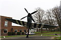
Replica Spitfire and MOD housing at RAF Benson
Image: © Roger Davies
Taken: 1 Jan 2016
0.03 miles
6
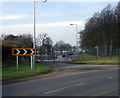
Old London Road
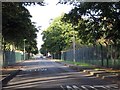
Before WW2 the road visible beyond the crash gates was part of the main road to Henley and London. Then Benson airfield was built over part of the route.
The former alignment is still obvious on the map.
Image: © Des Blenkinsopp
Taken: 27 Jan 2010
0.17 miles