
IMAGES TAKEN NEAR TO
Wantage Road, WALLINGFORD, OX10 0LU
Introduction
This page details the photographs taken nearby to Wantage Road, OX10 0LU by members of the Geograph project.
The Geograph project started in 2005 with the aim of publishing, organising and preserving representative images for every square kilometre of Great Britain, Ireland and the Isle of Man.

There are currently over 7.5m images from over14,400 individuals and you can help contribute to the project by visiting https://www.geograph.org.uk
Image Map
Images are licensed for reuse under creativecommons.org/licenses/by-sa/2.0
Notes
- Clicking on the map will re-center to the selected point.
- The higher the marker number, the further away the image location is from the centre of the postcode.
Image Listing (40 Images Found)
Images are licensed for reuse under creativecommons.org/licenses/by-sa/2.0
Image
Details
Distance
1
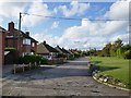
Residential ribbon-development by the Wantage road
At a guess I'd say the houses here look post-1970. Unlike properties further south-east (towards Wallingford) these get their own access road, setting them back a fair distance from the through traffic.
Image: © Stefan Czapski
Taken: 15 Oct 2019
0.04 miles
2
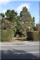
#126 Wantage Road - detached house behind the trees
There is an OS benchmark Image on the right hand side of the house at the front corner
Image: © Roger Templeman
Taken: 21 Feb 2014
0.06 miles
3
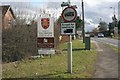
Town of Wallingford
The town sign on boundary of Wallingford along with a weight restriction sign.
Image: © Bill Nicholls
Taken: 21 Feb 2010
0.06 miles
4
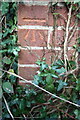
Benchmark on #126 Wantage Road
Ordnance Survey cut mark benchmark described on the Bench Mark Database at http://www.bench-marks.org.uk/bm26029
Image: © Roger Templeman
Taken: 21 Feb 2014
0.06 miles
5
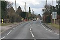
Cars on the Wantage Road
View down the Wantage Road Wallingford from near the roundabout.
Image: © Bill Nicholls
Taken: 21 Feb 2010
0.06 miles
6

Roundabout on Wantage Road, Brightwell-cum-Sotwell
Image: © David Howard
Taken: 23 Mar 2019
0.07 miles
7

Field edge on the Bypass
The edge of the cropland beside the Wallingford Bypass which is under threat from development.
Image: © Bill Nicholls
Taken: 9 Oct 2011
0.08 miles
8

Sign on the gate
One of the protest signs on a gate off the Wantage road Roundabout near Wallingford
Image: © Bill Nicholls
Taken: 21 Feb 2010
0.09 miles
9

Footpath through the field
View of the footpath running through the cropland where they want to build houses at Wallingford
Image: © Bill Nicholls
Taken: 21 Feb 2010
0.09 miles
10

Roundabout on Wantage Road, Brightwell-cum-Sotwell
Image: © David Howard
Taken: 23 Mar 2019
0.09 miles