
IMAGES TAKEN NEAR TO
Manchester Street, OLDHAM, OL8 1UF
Introduction
This page details the photographs taken nearby to Manchester Street, OL8 1UF by members of the Geograph project.
The Geograph project started in 2005 with the aim of publishing, organising and preserving representative images for every square kilometre of Great Britain, Ireland and the Isle of Man.

There are currently over 7.5m images from over14,400 individuals and you can help contribute to the project by visiting https://www.geograph.org.uk
Image Map
Images are licensed for reuse under creativecommons.org/licenses/by-sa/2.0
Notes
- Clicking on the map will re-center to the selected point.
- The higher the marker number, the further away the image location is from the centre of the postcode.
Image Listing (30 Images Found)
Images are licensed for reuse under creativecommons.org/licenses/by-sa/2.0
Image
Details
Distance
1
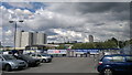
View of Oldham from Werneth
A view towards central Oldham, from the Werneth part of the town, in Greater Manchester, England. The tower on the centre-right is the Civic Centre. Those on the left are Crossbank House and Summervale House, which are high-rise accommodation blocks built in the last century to replace much of Oldham's squalid terraced housing.
In the foreground is a rather unglamorous Wicks carpark.
Image: © Steven Haslington
Taken: 29 Jun 2011
0.02 miles
2
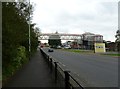
Oldham, footbridge
Over Manchester Street.
Image: © Mike Faherty
Taken: 19 Sep 2011
0.05 miles
3
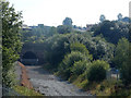
Railway tunnel
Taken from the bridge in Image This is the first of 2 tunnels into Oldham.
Image: © Stephen Darlington
Taken: 23 Aug 2015
0.09 miles
4
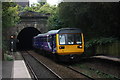
Class 142 train emerges from tunnel at Oldham Werneth
Just a fortnight prior to the Oldham Loop line closure for conversion to Metrolink tram operation a class 142 train approaches Oldham Werneth station
Image: © JOHN PARKIN
Taken: 19 Sep 2009
0.10 miles
5
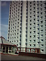
Summervale House
One of the twin tower blocks at the end of Manchester Street. Photo taken 8th August 2004, just after they were both re-clad.
Image: © Mark Underwood
Taken: 8 Aug 2004
0.10 miles
6
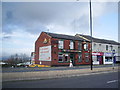
The Friendship Inn, 280 Manchester Street, Oldham
Image: © Alexander P Kapp
Taken: 8 Oct 2007
0.11 miles
7
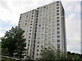
Flats on Vale Drive, Oldham
Built in the brutalist style of architecture which was in vogue in the 1950s to 1970s.
Image: © philandju
Taken: 18 Sep 2017
0.12 miles

9
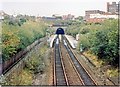
Oldham Werneth station 1988
Werneth tunnel immediately beyond
Image: © Peter Whatley
Taken: 8 Oct 1988
0.13 miles
10
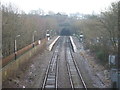
Oldham Werneth railway station, Greater Manchester
Opened in 1842 on what became the Lancashire & Yorkshire Railway's "Oldham Loop" line from Manchester to Rochdale, this station closed to passengers in 2009.
View east towards Oldham Central and Rochdale. Compare with Image
Image: © Nigel Thompson
Taken: 10 Jan 2009
0.14 miles