IMAGES TAKEN NEAR TO
Tiverton Place, ASHTON-UNDER-LYNE, OL7 9RJ
Introduction
This page details the photographs taken nearby to Tiverton Place, OL7 9RJ by members of the Geograph project.
The Geograph project started in 2005 with the aim of publishing, organising and preserving representative images for every square kilometre of Great Britain, Ireland and the Isle of Man.

There are currently over 7.5m images from over14,400 individuals and you can help contribute to the project by visiting https://www.geograph.org.uk
Image Map
Images are licensed for reuse under creativecommons.org/licenses/by-sa/2.0
Notes
- Clicking on the map will re-center to the selected point.
- The higher the marker number, the further away the image location is from the centre of the postcode.
Image Listing (30 Images Found)
Images are licensed for reuse under creativecommons.org/licenses/by-sa/2.0
Image
Details
Distance
1
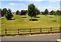
Dale Grove
A green space off Wilshaw Lane.
Image: © Gerald England
Taken: 17 Aug 2016
0.07 miles
2

Rock Mill
Rock Mill, in the Waterloo district of Ashton-Under-Lyne, during demolition work in March 1971. The former cotton spinning mill was built between 1891 and 1893. It ceased production in the 1960s and was demolished in 1971, having been bought by ASDA and became the site of the first purpose-built supermarket in Tameside. (ASDA later moved to the site of another mill, Wharf Mill - http://menmedia.co.uk/tamesideadvertiser/community/nostalgia/s/383455_the_1970s Tameside Advertiser.)
http://www.ashton-under-lyne.com/photos/gallery101.htm for a photo of the mill whilst still in use.
Image: © David Dixon
Taken: Unknown
0.09 miles
3

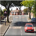
Dales Brow Avenue, Ashton-Under-Lyne
Image: © Alexander P Kapp
Taken: 23 Nov 2011
0.12 miles
4

New houses on Atlas Street, Ashton-Under-Lyne
Image: © Alexander P Kapp
Taken: 23 Nov 2011
0.14 miles
5
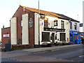
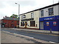
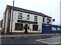
The Woodman
Public house, Oldham Road, Ashton.
Image: © David Dixon
Taken: 30 Jan 2010
0.16 miles
6
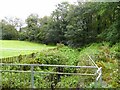
Smallshaw Brook
Entering a culvert to pass under the former Ashton to Oldham railway
Image: © Kevin Waterhouse
Taken: 2 Oct 2023
0.16 miles
9
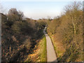
Ashton to Oldham (via Park Bridge) Railway
The disused Ashton to Oldham (via Park Bridge) Railway line, now converted into a foot/cycle path. View looking (towards Park Bridge) from the bridge at Cranbourne Road.
Image: © David Dixon
Taken: 2 Mar 2011
0.17 miles