IMAGES TAKEN NEAR TO
Back Lane, ASHTON-UNDER-LYNE, OL7 9JZ
Introduction
This page details the photographs taken nearby to Back Lane, OL7 9JZ by members of the Geograph project.
The Geograph project started in 2005 with the aim of publishing, organising and preserving representative images for every square kilometre of Great Britain, Ireland and the Isle of Man.

There are currently over 7.5m images from over14,400 individuals and you can help contribute to the project by visiting https://www.geograph.org.uk
Image Map (Loading...)


Getting Data...Please wait
Leaflet Map data © OpenStreetMap
Images are licensed for reuse under creativecommons.org/licenses/by-sa/2.0
Notes
- Clicking on the map will re-center to the selected point.
- The higher the marker number, the further away the image location is from the centre of the postcode.
Image Listing (29 Images Found)
Images are licensed for reuse under creativecommons.org/licenses/by-sa/2.0
Image
Details
Distance
1
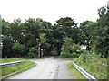
Junction of Lanes on Ashton Moss, Ashton-under-Lyne
Left for Jaum Farm, right for cottages on Back Lane and straight on for Buckley Hill Farm.
Image: © John Topping
Taken: 13 Sep 2012
0.02 miles
2
Entrance to Jaum Farm, Ashton-under-Lyne
Image: © John Topping
Taken: 13 Sep 2012
0.03 miles
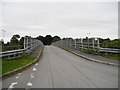
3
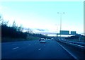
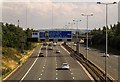
Back Lane Bridge over the M60 (1)
Ashton Moss, Ashton-under-Lyne.
Image: © John Topping
Taken: 13 Sep 2012
0.04 miles
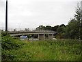
5
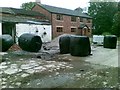
New farmhouse, Jaum Farm, Ashton-Under-Lyne
Image: © Alex McGregor
Taken: 16 Jun 2011
0.06 miles
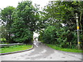
6
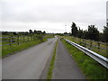
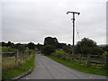
Back Lane (1), Ashton-under-Lyne
Looking southeast to Ashton Moss.
Image: © John Topping
Taken: 13 Sep 2012
0.07 miles
10
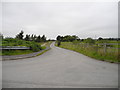
Lane to Hope Fold Farm, Ashton-under-Lyne
Looking east from Back Lane.
Image: © John Topping
Taken: 13 Sep 2012
0.12 miles