IMAGES TAKEN NEAR TO
Elgin Street, ASHTON-UNDER-LYNE, OL7 9BQ
Introduction
This page details the photographs taken nearby to Elgin Street, OL7 9BQ by members of the Geograph project.
The Geograph project started in 2005 with the aim of publishing, organising and preserving representative images for every square kilometre of Great Britain, Ireland and the Isle of Man.

There are currently over 7.5m images from over14,400 individuals and you can help contribute to the project by visiting https://www.geograph.org.uk
Image Map
Images are licensed for reuse under creativecommons.org/licenses/by-sa/2.0
Notes
- Clicking on the map will re-center to the selected point.
- The higher the marker number, the further away the image location is from the centre of the postcode.
Image Listing (46 Images Found)
Images are licensed for reuse under creativecommons.org/licenses/by-sa/2.0
Image
Details
Distance
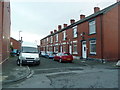
2

New houses on Atlas Street, Ashton-Under-Lyne
Image: © Alexander P Kapp
Taken: 23 Nov 2011
0.04 miles
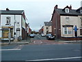
4
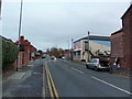
Cranbourne Road, Ashton-Under-Lyne
Image: © Alexander P Kapp
Taken: 23 Nov 2011
0.06 miles
5

Dales Brow Avenue, Ashton-Under-Lyne
Image: © Alexander P Kapp
Taken: 23 Nov 2011
0.06 miles
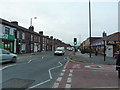
7
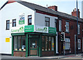
Corner shop, Ashton-under-Lyne
At the end of a terrace of houses on the corner of Westbourne Drive and Oldham Road. When I was a lad corner shops sold groceries. Now they sell loans with which to buy the groceries.
Image: © michael ely
Taken: 12 May 2008
0.09 miles
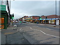
8
Bradbury Street, Ashton-Under-Lyne
Image: © Alexander P Kapp
Taken: 23 Nov 2011
0.12 miles
9

Rock Mill
Rock Mill, in the Waterloo district of Ashton-Under-Lyne, during demolition work in March 1971. The former cotton spinning mill was built between 1891 and 1893. It ceased production in the 1960s and was demolished in 1971, having been bought by ASDA and became the site of the first purpose-built supermarket in Tameside. (ASDA later moved to the site of another mill, Wharf Mill - http://menmedia.co.uk/tamesideadvertiser/community/nostalgia/s/383455_the_1970s Tameside Advertiser.)
http://www.ashton-under-lyne.com/photos/gallery101.htm for a photo of the mill whilst still in use.
Image: © David Dixon
Taken: Unknown
0.14 miles
10
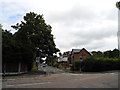
Knowle Avenue (1)
Junction of Knowle Avenue (east end) and Taunton Road. Crowhill area of Ashton-under-Lyne.
Image: © John Topping
Taken: 13 Sep 2012
0.15 miles