
IMAGES TAKEN NEAR TO
Welbeck Street South, ASHTON-UNDER-LYNE, OL7 0PN
Introduction
This page details the photographs taken nearby to Welbeck Street South, OL7 0PN by members of the Geograph project.
The Geograph project started in 2005 with the aim of publishing, organising and preserving representative images for every square kilometre of Great Britain, Ireland and the Isle of Man.

There are currently over 7.5m images from over14,400 individuals and you can help contribute to the project by visiting https://www.geograph.org.uk
Image Map
Images are licensed for reuse under creativecommons.org/licenses/by-sa/2.0
Notes
- Clicking on the map will re-center to the selected point.
- The higher the marker number, the further away the image location is from the centre of the postcode.
Image Listing (469 Images Found)
Images are licensed for reuse under creativecommons.org/licenses/by-sa/2.0
Image
Details
Distance
1
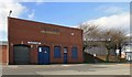
Taxiland
A garage specialising in servicing taxis, housed in the former Victoria Corn Mill on Victoria Street.
Image: © Gerald England
Taken: 21 Mar 2015
0.04 miles
2
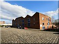
Portland Basin Museum
After a major refurbishment and enlargement, the Portland Basin Heritage Centre re-opened in March 1999 as the Portland Basin Museum. Housed in the former Ashton Canal Warehouse, the Museum is situated alongside the Ashton Canal at Portland Basin, Ashton under Lyne, opposite the junction with the Peak Forest Canal. http://www.ashton-under-lyne.com/places/portlandbasinmuseum.htm
Image: © Gerald England
Taken: 21 Mar 2015
0.04 miles
3
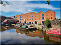
Ashton Canal Warehouse/Portland Basin Museum
The three-storey, red-brick building was originally built in 1834 as a warehouse for the Ashton Canal Company (Image]). It was rebuilt and refurbished in 1999, following a fire. The bottom two floors now house a museum https://www.tameside.gov.uk/portlandbasin (Tameside MBC).
Image: © David Dixon
Taken: 9 Aug 2022
0.05 miles
4
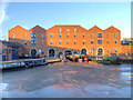
Ashton Canal, Portland Basin Museum
The large building opposite is the home of the Portland Basin Museum. It was originally built in 1834 as a warehouse for the Ashton Canal Company (Image]). It was rebuilt and refurbished in 1999, following a fire.
Image: © David Dixon
Taken: 13 Dec 2012
0.05 miles
5
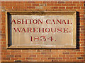
Ashton Canal Warehouse Plaque
Plaque on the refurbished Ashton Canal Warehouse. Dated 1834 (but rebuilt in 1999 following a major fire), the warehouse now houses the Portland Basin Museum (Image]).
Image: © David Dixon
Taken: 13 Dec 2012
0.05 miles
6
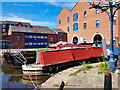
Narrowboats at the Portland Basin Museum
The three-storey, red-brick building was originally built in 1834 as a warehouse for the Ashton Canal Company (Image]). It was rebuilt and refurbished in 1999, following a fire. The bottom two floors now house a museum https://www.tameside.gov.uk/portlandbasin (Tameside MBC).
Image: © David Dixon
Taken: 9 Aug 2022
0.05 miles
7
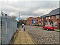
Portland Street South
Leading to the Portland Basin.
Image: © Gerald England
Taken: 24 Feb 2012
0.05 miles
8
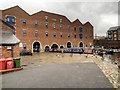
Portland Basin Museum, Ashton Canal Warehouse
This large building is the home of the Portland Basin Museum. It was originally built in 1834 as a warehouse for the Ashton Canal Company (Image]). It was rebuilt and refurbished in 1999, following a fire.
Image: © David Dixon
Taken: 28 May 2014
0.06 miles
9
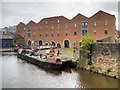
Ashton Canal Warehouse, The Portland Basin Museum
The large building opposite is the home of the Portland Basin Museum. It was originally built in 1834 as a warehouse for the Ashton Canal Company (Image]). It was rebuilt and refurbished in 1999, following a fire.
Image: © David Dixon
Taken: 28 May 2014
0.06 miles
10
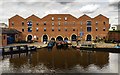
Portland Basin
Portland Basin on the Ashton Canal.
Image: © Peter McDermott
Taken: 26 Jun 2017
0.06 miles