
IMAGES TAKEN NEAR TO
Knight Street, ASHTON-UNDER-LYNE, OL7 0EJ
Introduction
This page details the photographs taken nearby to Knight Street, OL7 0EJ by members of the Geograph project.
The Geograph project started in 2005 with the aim of publishing, organising and preserving representative images for every square kilometre of Great Britain, Ireland and the Isle of Man.

There are currently over 7.5m images from over14,400 individuals and you can help contribute to the project by visiting https://www.geograph.org.uk
Image Map
Images are licensed for reuse under creativecommons.org/licenses/by-sa/2.0
Notes
- Clicking on the map will re-center to the selected point.
- The higher the marker number, the further away the image location is from the centre of the postcode.
Image Listing (40 Images Found)
Images are licensed for reuse under creativecommons.org/licenses/by-sa/2.0
Image
Details
Distance
1
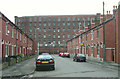
Ryecroft Mill, Ashton under Lyne
Rycroft Mill, built in 1837, was one of many cotton mills in Ashton under Lyne. It is seen here looking north-west along Hamilton Street.
Image: © Martin Clark
Taken: Unknown
0.02 miles
2
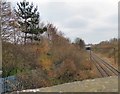
Ashton Moss Curve
This railway line, sometimes referred to as the Richmond Curve or the Crowthorn Curve, leaves the line from Manchester Victoria to Stalybridge and curves round bypassing Guide Bridge to join the line through Denton and Reddish South to Stockport. It is now well used as a freight line only.
Image: © Gerald England
Taken: 12 Mar 2016
0.02 miles
4
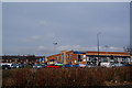
Evans Halshaw, Manchester Road, Ashton-under-Lyne
This is taken from the other side of Manchester Road. A useful landmark just near the M60 junction 23. When it was Quick's it was known as 'Quick's'. Now it is just known as 'the Ford garage'.
Image: © Bill Boaden
Taken: 5 Mar 2010
0.07 miles
5
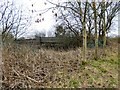
Moss Lane railway bridge
Over the Ashton Moss Curve.
Image: © Gerald England
Taken: 12 Mar 2016
0.08 miles
7
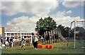
Oakdale Sports Day
Sports day at Oakdale School. The school off Manchester Road on Ashton Moss was a primary/junior school for pupils with Special Needs. It was demolished to make way for the M60 motorway.
Image: © Gerald England
Taken: Unknown
0.09 miles
8
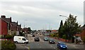
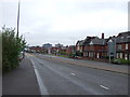
Manchester Road
The A635 approaching M60 Junction 23.
Image: © Gerald England
Taken: 6 Sep 2010
0.10 miles
9
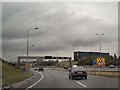
M60 Junction 23
The slip road joining the M60 at junction 23. The large, black, rectangular building on the other side is The Village Hotel, Ashton Moss.
Image: © David Dixon
Taken: 20 Jul 2010
0.10 miles
10
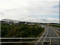
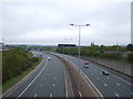
M60 Motorway
The M60 North of the A635. The buildings on the left are part of the Ashton Moss Retail complex.
Image: © Gerald England
Taken: 4 Jul 2008
0.11 miles