IMAGES TAKEN NEAR TO
Lytham Close, ASHTON-UNDER-LYNE, OL6 9ER
Introduction
This page details the photographs taken nearby to Lytham Close, OL6 9ER by members of the Geograph project.
The Geograph project started in 2005 with the aim of publishing, organising and preserving representative images for every square kilometre of Great Britain, Ireland and the Isle of Man.

There are currently over 7.5m images from over14,400 individuals and you can help contribute to the project by visiting https://www.geograph.org.uk
Image Map
Images are licensed for reuse under creativecommons.org/licenses/by-sa/2.0
Notes
- Clicking on the map will re-center to the selected point.
- The higher the marker number, the further away the image location is from the centre of the postcode.
Image Listing (22 Images Found)
Images are licensed for reuse under creativecommons.org/licenses/by-sa/2.0
Image
Details
Distance
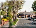
1
Kings Road/Weymouth Road, Higher Hurst
New development by Hunters, named Weymouth Gardens. Kings Road on the left is for residents access only.
Image: © John Topping
Taken: 31 Mar 2013
0.12 miles
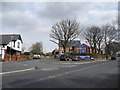
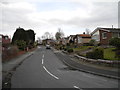
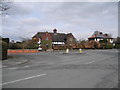
2
Kings Road
The Eastern end of Kings Road at its junction with Weymouth Road. Viewed from the top deck of a bus.
Image: © Gerald England
Taken: 18 Apr 2011
0.13 miles
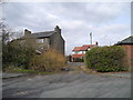
3
Weymouth Road, Higher Hurst
At the junction with Kings Road (left) and Rosh Hill Road (right).
Image: © John Topping
Taken: 31 Mar 2013
0.15 miles
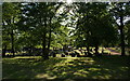
4
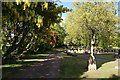
A quieter corner of Hurst Cemetery
With laburnum and may in flower.
Image: © Bill Boaden
Taken: 27 May 2010
0.15 miles
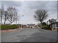
6
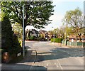
Weymouth Road
Junction of Weymouth Road and Rose Hill Road. Viewed from the top deck of a bus.
Image: © Gerald England
Taken: 18 Apr 2011
0.16 miles
7
Rose Hill Road
Approaching Weymouth Road. Viewed from the top deck of a bus.
Image: © Gerald England
Taken: 18 Apr 2011
0.17 miles
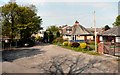
8
Unnamed short cut, between Gorsey Lane and Kings Road
Viewed from Kings Road.
Image: © John Topping
Taken: 31 Mar 2013
0.17 miles
9
Gorsey Lane junction with Kings Road
Viewed from Kings Road.
Image: © John Topping
Taken: 31 Mar 2013
0.19 miles
10
Sun through the trees at Hurst Cemetery
Image: © Bill Boaden
Taken: 27 May 2010
0.19 miles