IMAGES TAKEN NEAR TO
Bamford Grove, ASHTON-UNDER-LYNE, OL6 9BE
Introduction
This page details the photographs taken nearby to Bamford Grove, OL6 9BE by members of the Geograph project.
The Geograph project started in 2005 with the aim of publishing, organising and preserving representative images for every square kilometre of Great Britain, Ireland and the Isle of Man.

There are currently over 7.5m images from over14,400 individuals and you can help contribute to the project by visiting https://www.geograph.org.uk
Image Map (Loading...)


Getting Data...Please wait
Leaflet Map data © OpenStreetMap
Images are licensed for reuse under creativecommons.org/licenses/by-sa/2.0
Notes
- Clicking on the map will re-center to the selected point.
- The higher the marker number, the further away the image location is from the centre of the postcode.
Image Listing (22 Images Found)
Images are licensed for reuse under creativecommons.org/licenses/by-sa/2.0
Image
Details
Distance
1
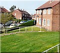
Hazelhurst Road
From the end of Ashbourne Drive.
Image: © Gerald England
Taken: 18 Apr 2011
0.08 miles
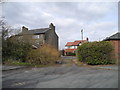
2
Gorsey Lane junction with Kings Road
Viewed from Kings Road.
Image: © John Topping
Taken: 31 Mar 2013
0.12 miles
3
Unnamed short cut, between Gorsey Lane and Kings Road
Viewed from Kings Road.
Image: © John Topping
Taken: 31 Mar 2013
0.12 miles
4
Rose Hill Road
Approaching Weymouth Road. Viewed from the top deck of a bus.
Image: © Gerald England
Taken: 18 Apr 2011
0.13 miles
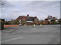
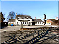
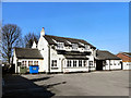
5
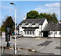
The Peaks
On Gorsey Lane at the junction with Hazelhurst Road. Built for Gartside's Brewery in 1962 on a site previously occupied by some cottages and a shop.
Image: © Gerald England
Taken: 18 Apr 2011
0.13 miles
6
Weymouth Road
Junction of Weymouth Road and Rose Hill Road. Viewed from the top deck of a bus.
Image: © Gerald England
Taken: 18 Apr 2011
0.13 miles
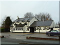
8
The Peaks
The Peaks, Gorsey Lane, Hurst.
Image: © David Dixon
Taken: 2 Mar 2011
0.14 miles
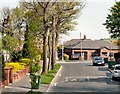
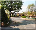
10
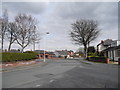
Weymouth Road, Higher Hurst
At the junction with Kings Road (left) and Rosh Hill Road (right).
Image: © John Topping
Taken: 31 Mar 2013
0.14 miles