
IMAGES TAKEN NEAR TO
Warre Street, ASHTON-UNDER-LYNE, OL6 8NW
Introduction
This page details the photographs taken nearby to Warre Street, OL6 8NW by members of the Geograph project.
The Geograph project started in 2005 with the aim of publishing, organising and preserving representative images for every square kilometre of Great Britain, Ireland and the Isle of Man.

There are currently over 7.5m images from over14,400 individuals and you can help contribute to the project by visiting https://www.geograph.org.uk
Image Map
Images are licensed for reuse under creativecommons.org/licenses/by-sa/2.0
Notes
- Clicking on the map will re-center to the selected point.
- The higher the marker number, the further away the image location is from the centre of the postcode.
Image Listing (459 Images Found)
Images are licensed for reuse under creativecommons.org/licenses/by-sa/2.0
Image
Details
Distance
1
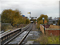
Ashton-Under-Lyne Station
Looking west (towards Manchester) from the platform at Ashton Station.
Image: © David Dixon
Taken: 8 Nov 2012
0.02 miles
2
Ashton: Looking west from the station
The Distant signal is actually not a fixed Distant, although it is seldom, if ever, pulled off. This is taken looking west from Ashton station, which formerly was known as Ashton (Charlestown), in the days when Ashton had no less than five stations.
Image: © Dr Neil Clifton
Taken: 24 Oct 2013
0.02 miles
3
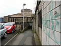
Turner Street
Pedestrian way under the railway from the end of Turner Street leading to Wellington Road.
Image: © Gerald England
Taken: 4 Apr 2011
0.02 miles
4
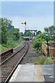
Signal, Ashton-under-Lyne railway station
The old-fashioned semaphore signal has a colour light signal built-in, and is still in use. Compare to Image
Image: © El Pollock
Taken: 30 May 2014
0.02 miles
5
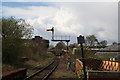
Ashton Charlestown
A view west along the railway line towards Manchester Victoria. Presumably the solitary semaphore distant signal will soon be removed.
Image: © Dr Neil Clifton
Taken: 26 Apr 2016
0.02 miles
6
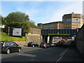
Bridge MVN1/23, Turner Lane at Ashton Station
The traffic is waiting to turn into Wellington Road.
Image: © Stephen Armstrong
Taken: 1 Jul 2011
0.03 miles
7
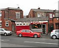
Snack Station
Sandwich shop on Turner Lane.
Image: © Gerald England
Taken: 4 Apr 2011
0.03 miles
8
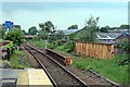
End of platform 2, Ashton-under-Lyne railway station
The tracks cross Turner Lane bridge, just beyond the end of the platform. The bridge was clearly built to accommodate an extra track, which has since been lifted. In the distance, the tracks then go beneath the A627 Oldham Road bridge.
Image: © El Pollock
Taken: 30 May 2014
0.03 miles
9
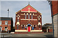
Ashton-under-Lyne: Independent Methodist Church
Opposite the bus station.
Image: © Dr Neil Clifton
Taken: 22 Sep 2010
0.04 miles
10
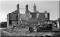
Charlestown - 1971
Last of the old Victorian houses in Charlestown being demolished, early in 1971. Not sure of the exact location, but it was just to the north of Charlestown Station, on one of the streets off Turner Lane or Yorkshire Street.
Image: © David Dixon
Taken: Unknown
0.04 miles