IMAGES TAKEN NEAR TO
Leech Avenue, ASHTON-UNDER-LYNE, OL6 8HH
Introduction
This page details the photographs taken nearby to Leech Avenue, OL6 8HH by members of the Geograph project.
The Geograph project started in 2005 with the aim of publishing, organising and preserving representative images for every square kilometre of Great Britain, Ireland and the Isle of Man.

There are currently over 7.5m images from over14,400 individuals and you can help contribute to the project by visiting https://www.geograph.org.uk
Image Map
Images are licensed for reuse under creativecommons.org/licenses/by-sa/2.0
Notes
- Clicking on the map will re-center to the selected point.
- The higher the marker number, the further away the image location is from the centre of the postcode.
Image Listing (33 Images Found)
Images are licensed for reuse under creativecommons.org/licenses/by-sa/2.0
Image
Details
Distance
1
Leech Avenue
Viewed from the top deck of a bus.
Image: © Gerald England
Taken: 18 Apr 2011
0.03 miles
2
Kings Road
At the corner with Prospect Road. Viewed from the top deck of a bus.
Image: © Gerald England
Taken: 18 Apr 2011
0.13 miles
3
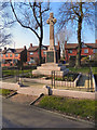
Hurst War Memorial
The Great War Memorial at the northern end of Hurst Cemetery was unveiled in January 1921 by Sir Walter de Frece, the MP for Ashton at that time.
The Gaelic cross stands 18ft high on top of a four sided plinth, surrounded by a small flowerbed. Each side of the plinth bears a cast bronze panel with names from the Great War. There are 185 names in all, and the panel also bears the inscription: "To the glory of God and in the loving memory of the men of Hurst who gave their lives for King and Country in the Great War, 1914-1919.” (http://www.tameside.gov.uk/warmemorial/hurstcemetery - Tameside MBC).
The houses behind are on King's Road.
Image: © David Dixon
Taken: 2 Mar 2011
0.13 miles
4
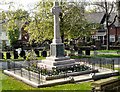
Hurst War Memorial
Inside Hurst Cemetery, by the Kings Road entrance. A Gaelic cross, 18ft high, standing on plinth, dye by three bases. A small flowerbed surrounds the bottom base, and access is gained by climbing two small steps. The plinth has four sides, each bearing a cast bronze panel with names from the Great War. There are 185 names in all, and the panel also bears the inscription: "To the glory of God and in the loving memory of the men of Hurst who gave their lives for King and Country in the Great War, 1914-1919." Made of Peterhead Red Granite, the memorial was erected by John Knott and Sons of Ashton at a cost of more than £1,000. It was unveiled by the M.P. for Ashton, Sir Walter de Frece, on January 15, 1921. http://www.tameside.gov.uk/warmemorial/hurstcemetery
Image: © Gerald England
Taken: 18 Apr 2011
0.14 miles
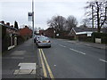
6
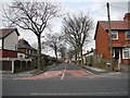
Hampson Road, Higher Hurst
At the junction with Kings Road.
Image: © John Topping
Taken: 31 Mar 2013
0.16 miles
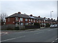
8
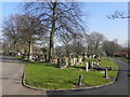
Hurst Cemetery
Hurst Cemetery, on King's Road.
Image: © David Dixon
Taken: 2 Mar 2011
0.18 miles
9
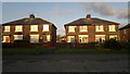
166 - 172 Queens Road, Ashton-under-Lyne
From right to left are 166 to 172 Queens Road, which are semi-detached properties in the Hurst Cross area of Ashton-under-Lyne, in Greater Manchester, England.
Image: © Steven Haslington
Taken: 19 Apr 2013
0.20 miles