IMAGES TAKEN NEAR TO
Queens Road, ASHTON-UNDER-LYNE, OL6 8EL
Introduction
This page details the photographs taken nearby to Queens Road, OL6 8EL by members of the Geograph project.
The Geograph project started in 2005 with the aim of publishing, organising and preserving representative images for every square kilometre of Great Britain, Ireland and the Isle of Man.

There are currently over 7.5m images from over14,400 individuals and you can help contribute to the project by visiting https://www.geograph.org.uk
Image Map (19 Images)
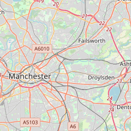
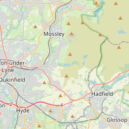
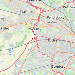

Leaflet Map data © OpenStreetMap
Images are licensed for reuse under creativecommons.org/licenses/by-sa/2.0
Notes
- Clicking on the map will re-center to the selected point.
- The higher the marker number, the further away the image location is from the centre of the postcode.
Image Listing (19 Images Found)
Images are licensed for reuse under creativecommons.org/licenses/by-sa/2.0
Image
Details
Distance
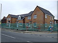
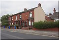
1
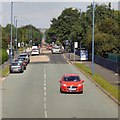
Queens Road
The B6194 through Hurst.
Image: © Gerald England
Taken: 17 Aug 2016
0.03 miles
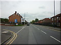
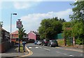
2
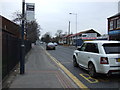
Bus stop on Queen's Road (B6194)
Looking north.
Image: © JThomas
Taken: 14 Mar 2015
0.04 miles
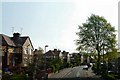
3

Whiteacre Road
Approaching the junction with Queens Road. Viewed from the top deck of a bus.
Image: © Gerald England
Taken: 18 Apr 2011
0.04 miles
7
Leech Avenue
Viewed from the top deck of a bus.
Image: © Gerald England
Taken: 18 Apr 2011
0.22 miles
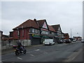
10

Sign for the Miners Arms, Ashton-under-Lyne
Image: © JThomas
Taken: 14 Mar 2015
0.23 miles