IMAGES TAKEN NEAR TO
Wood Street, ASHTON-UNDER-LYNE, OL6 7NA

Introduction

This page details the photographs taken nearby to Wood Street, OL6 7NA by members of the Geograph project.

The Geograph project started in 2005 with the aim of publishing, organising and preserving representative images for every square kilometre of Great Britain, Ireland and the Isle of Man.

There are currently over 7.5m images from over14,400 individuals and you can help contribute to the project by visiting https://www.geograph.org.uk

Image Map


Images are licensed for reuse under creativecommons.org/licenses/by-sa/2.0
Notes
  • Clicking on the map will re-center to the selected point.
  • The higher the marker number, the further away the image location is from the centre of the postcode.

Image Listing (625 Images Found)

Images are licensed for reuse under creativecommons.org/licenses/by-sa/2.0
  • ...
Image
Details
Distance
1
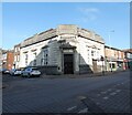
Stamford House
Originally the County Bank and later the Trustee Savings Bank. In 2010 it was "Gigi's Bar" but now it seems to be divided between a tattoo parlour and the "Amazing Good News Gospel Church" Image
Image: © Gerald England Taken: 13 Feb 2023
0.02 miles
2
Booth Street
Image: © Peter Whatley Taken: 24 Jan 2009
0.02 miles
3
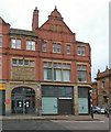
Clarence Arcade
Clarence Arcade was built in 1894 and housed a variety of different shop. It is currently owned by Jersey Street Properties and has been regenerated as high-quality office space. http://public.tameside.gov.uk/pressreleases/f1030pressreleasestory107.asp?story=396 In the 1980s the end unit was a branch of Comet electricals. Now it houses "Positive Steps" http://www.positive-steps.org.uk/ which "provides a range of targeted and integrated services to young people and adults designed to get them on the right track and fulfil their potential." Image
Image: © Gerald England Taken: 23 Jan 2016
0.03 miles
4
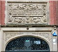
Clarence Arcade: Architectural detail
The entrance to Clarence Arcade Image
Image: © Gerald England Taken: 23 Jan 2016
0.03 miles
5
The Caledonia
On the corner of Warrington Street and Wood Street. The pub, sometimes known as the "Caledonian House" dates back to 1854. From 1891 to 1899 it belonged to Chesters Brewery when it passed to Schofield's Portland Brewery until 1926 when it was bought by Robinson's. Image
Image: © Gerald England Taken: 3 Jun 2010
0.03 miles
6
Stamford Street
Once a busy shopping street that declined in the 80s and 90s, Stamford Street is enjoying something of a revival.
Image: © Gerald England Taken: 5 Jun 2009
0.03 miles
7
Oddfellows Hall
The Grade II listed https://historicengland.org.uk/listing/the-list/list-entry/1068002?section=official-list-entry Oddfellows Hall (and former Ashetton Arms) was built in 1855 as a meeting place for the Oddfellows organisation. It was empty for a long time and part of it collapsed in 1998. It has since been restored.
Image: © Gerald England Taken: 13 Feb 2023
0.03 miles
8
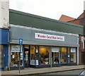
Wooden Canal Boat Society Shop
Charity shop for the Wooden Canal Boat Society http://wcbs.org.uk/
Image: © Gerald England Taken: 23 Jan 2016
0.03 miles
9
Oddfellows Hall
The hall on the corner of Stamford Street and Booth Street was built in 1855 as a meeting place for the Oddfellows organisation. The Grade 2 Listed building was empty for a long time and part of it collapsed in 1998. It has since been restored. More information at http://ashton-under-lyne.blogspot.com/2008/05/oddfellows-hall.html
Image: © Gerald England Taken: 5 Jun 2009
0.03 miles
10
179 Stamford Street Central
Former National Westminster bank.
Image: © Gerald England Taken: 4 Apr 2011
0.03 miles
  • ...