
IMAGES TAKEN NEAR TO
The Wellington Centre, Whitelands Road, ASHTON-UNDER-LYNE, OL6 6UY
Introduction
This page details the photographs taken nearby to The Wellington Centre, Whitelands Road, OL6 6UY by members of the Geograph project.
The Geograph project started in 2005 with the aim of publishing, organising and preserving representative images for every square kilometre of Great Britain, Ireland and the Isle of Man.

There are currently over 7.5m images from over14,400 individuals and you can help contribute to the project by visiting https://www.geograph.org.uk
Image Map
Images are licensed for reuse under creativecommons.org/licenses/by-sa/2.0
Notes
- Clicking on the map will re-center to the selected point.
- The higher the marker number, the further away the image location is from the centre of the postcode.
Image Listing (126 Images Found)
Images are licensed for reuse under creativecommons.org/licenses/by-sa/2.0
Image
Details
Distance
1
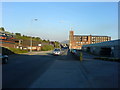
Plantation Industrial Estate
Looking east, towards Stalybridge, along Whitelands Road, Ashton-under-Lyne.
Image: © Keith Williamson
Taken: 5 Oct 2007
0.02 miles
2
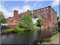
Wellington Mill
Wellington Mill was a cotton mill built around 150 years ago, situated between Whitelands Road and the Huddersfield Narrow Canal. This is one of the relatively few still standing from the hundreds that were built in Greater Manchester. They made fortunes for a few men but were places of long hours, poor health and low pay for the many workers.
Image: © Stephen Burton
Taken: 24 May 2018
0.02 miles
3

Old Boundary Marker on the Huddersfield Canal in Ashton-under-Lyne
Parish Boundary Marker beside the towpath of the Huddersfield Narrow Canal south of Whitelands Road. On the former boundary of Ashton-under-Lyne, Lancashire and Dukinfield, Cheshire but now entirely in an unparished area of Tameside Metropolitan District. A is assumed to indicate Ashton-under-Lyne.
Milestone Society National ID: LA_AULDUK03pb
Image: © D Garside
Taken: 10 Mar 2022
0.02 miles
4
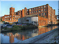
Huddersfield Narrow Canal, Wellington Mill
Wellington Mill, alongside the Huddersfield Narrow Canal at Whitelands, was built in 1857.
Image: © David Dixon
Taken: 13 Dec 2012
0.03 miles
5

Whitelands Road
Industrial area near Wellington Mill, looking towards Ashton.
Image: © Gerald England
Taken: 15 Jul 2011
0.05 miles
6
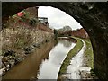
The Huddersfield Narrow Canal
Viewed from under a bridge
Image: © Graham Hogg
Taken: 18 Mar 2019
0.05 miles
7
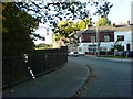
The Corner
Houses on Corner Street, Whitelands Road, Ashton-under-Lyne. Huddersfield Narrow Canal visible on left.
Image: © Keith Williamson
Taken: 5 Oct 2007
0.06 miles
8
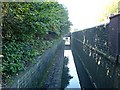
Huddersfield Narrow Canal
Looking roughly west towards the Minerva Road bridge and Whitelands Lock, beyond which lies Whitelands Basin and the Ashton Canal.
Image: © Keith Williamson
Taken: 5 Oct 2007
0.07 miles
9

Huddersfield Narrow Canal, Texas Street Bridge
Bridge Number 108 on the Huddersfield Canal at Ashton-Under-Lyne.
Image: © David Dixon
Taken: 13 Dec 2012
0.07 miles
10
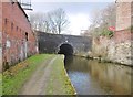
Ashton-under-Lyne, Bridge No 108
Carrying Texas Street over Huddersfield Narrow Canal.
Image: © Mike Faherty
Taken: 8 Feb 2019
0.08 miles