
IMAGES TAKEN NEAR TO
Queen Street, ASHTON-UNDER-LYNE, OL6 6NW
Introduction
This page details the photographs taken nearby to Queen Street, OL6 6NW by members of the Geograph project.
The Geograph project started in 2005 with the aim of publishing, organising and preserving representative images for every square kilometre of Great Britain, Ireland and the Isle of Man.

There are currently over 7.5m images from over14,400 individuals and you can help contribute to the project by visiting https://www.geograph.org.uk
Image Map
Images are licensed for reuse under creativecommons.org/licenses/by-sa/2.0
Notes
- Clicking on the map will re-center to the selected point.
- The higher the marker number, the further away the image location is from the centre of the postcode.
Image Listing (134 Images Found)
Images are licensed for reuse under creativecommons.org/licenses/by-sa/2.0
Image
Details
Distance
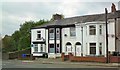
2
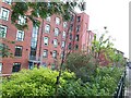
Harper Mill
Harper Mill built 1855 in Ashton-under-Lyne.
Known locally as Pickles mill, who owned it and had the name, ‘M PICKLES’ in large while letters high up, on the south wall.
The old cotton mill was devastated by fire and partially collapsed on the night of December 4th 1999. It never reopened.
Sailbridge Homes, turned it from a black hulk into 48 bright new apartments in 2004. Not all of the mill was saved and about a third was never rebuilt.
Image: © Mike Calverley
Taken: 13 Aug 2008
0.06 miles
3
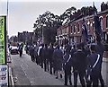
Boys Brigade Parade
The Boys Brigade marching down Mossley Road.
Image: © Gerald England
Taken: 20 Sep 1992
0.07 miles
4

Ashton-under-Lyne from Dukinfield
A view of Ashton-under-Lyne from Dukinfield Cemetery, in Tameside, Greater Manchester. On the horizon is Oldham.
Image: © Steven Haslington
Taken: 7 Mar 2011
0.08 miles
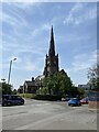
6
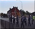
Stamford Road East
The Boys Brigade parade on Stamford Road East.
Image: © Gerald England
Taken: 20 Sep 1992
0.10 miles
7
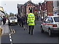
Up Penny Meadow
The Boys Brigade marching up Penny Meadow.
Image: © Gerald England
Taken: 20 Sep 1992
0.10 miles
9
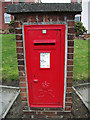
Brick-built postbox
Situated on the corner of Penny Meadow (A670) and Whiteacre Road (B6194) about one kilometre northeast of Ashton's town centre.
Image: © michael ely
Taken: 31 Jan 2011
0.11 miles
10
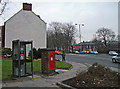
Phone box and post box
Situated on the corner of Penny Meadow (A670) and Whiteacre Road (B6194) about one kilometre northeast of Ashton's town centre.
Image: © michael ely
Taken: 31 Jan 2011
0.11 miles