
IMAGES TAKEN NEAR TO
Springfield Mews, ASHTON-UNDER-LYNE, OL5 9FN
Introduction
This page details the photographs taken nearby to Springfield Mews, OL5 9FN by members of the Geograph project.
The Geograph project started in 2005 with the aim of publishing, organising and preserving representative images for every square kilometre of Great Britain, Ireland and the Isle of Man.

There are currently over 7.5m images from over14,400 individuals and you can help contribute to the project by visiting https://www.geograph.org.uk
Image Map
Images are licensed for reuse under creativecommons.org/licenses/by-sa/2.0
Notes
- Clicking on the map will re-center to the selected point.
- The higher the marker number, the further away the image location is from the centre of the postcode.
Image Listing (31 Images Found)
Images are licensed for reuse under creativecommons.org/licenses/by-sa/2.0
Image
Details
Distance
2
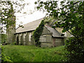
All Saints' Parish Church, Micklehurst
All Saints' Parish church, on Church Street, Micklehurst, first opened in 1894 but now lies derelict, with its grounds badly overgrown.
Image: © David Dixon
Taken: 14 Jun 2011
0.17 miles
3
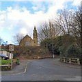
All Saints, Micklehurst
All Saints Parish Church, Micklehurst dates from 1893 but has been redundant since 2006. Viewed from the corner of Station Road and King Street.
Image: © Gerald England
Taken: 18 Feb 2016
0.18 miles
4
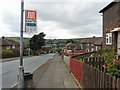
Winterford Road
Looking down towards Mossley.
Image: © Gerald England
Taken: 12 Aug 2009
0.18 miles
5
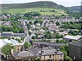
Bottom Mossley
Taken from Mossley Old Town Hall.
Image: © Richard Brierley
Taken: 23 Jun 2006
0.19 miles
6
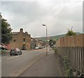
Micklehurst Road
To the left is Station Road; to the right is Cheshire Street.
Image: © Gerald England
Taken: 22 Jun 2009
0.20 miles
7
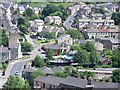
Bottom Mossley
Taken from Mossley Old Town Hall.
Image: © Richard Brierley
Taken: 23 Jun 2006
0.20 miles
8
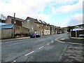
Micklehurst Road
The first group of houses on the left are the Ponge Buildings Image There is a Victorian letterbox Image in the wall of one house.
Image: © Gerald England
Taken: 18 Feb 2016
0.20 miles
9
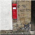
V R Postbox (OL5 114)
A thin Victorian wall box (OL5 114) on the wall of the Ponge Buildings Image on Micklehurst Road Image
Image: © Gerald England
Taken: 18 Feb 2016
0.21 miles
10
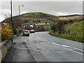
Micklehurst, Huddersfield Road
The B6175 (Huddersfield Road) at Micklehurst.
Image: © David Dixon
Taken: 25 Nov 2011
0.21 miles