
IMAGES TAKEN NEAR TO
The Laurels, ASHTON-UNDER-LYNE, OL5 9DW
Introduction
This page details the photographs taken nearby to The Laurels, OL5 9DW by members of the Geograph project.
The Geograph project started in 2005 with the aim of publishing, organising and preserving representative images for every square kilometre of Great Britain, Ireland and the Isle of Man.

There are currently over 7.5m images from over14,400 individuals and you can help contribute to the project by visiting https://www.geograph.org.uk
Image Map
Images are licensed for reuse under creativecommons.org/licenses/by-sa/2.0
Notes
- Clicking on the map will re-center to the selected point.
- The higher the marker number, the further away the image location is from the centre of the postcode.
Image Listing (31 Images Found)
Images are licensed for reuse under creativecommons.org/licenses/by-sa/2.0
Image
Details
Distance
1
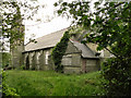
All Saints' Parish Church, Micklehurst
All Saints' Parish church, on Church Street, Micklehurst, first opened in 1894 but now lies derelict, with its grounds badly overgrown.
Image: © David Dixon
Taken: 14 Jun 2011
0.12 miles
2
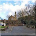
All Saints, Micklehurst
All Saints Parish Church, Micklehurst dates from 1893 but has been redundant since 2006. Viewed from the corner of Station Road and King Street.
Image: © Gerald England
Taken: 18 Feb 2016
0.13 miles
3

Micklehurst Loop Line
Footpath along the route of the former Micklehurst Loop line.
The Micklehurst Loop was constructed by the LNWR in 1881 and opened in 1886. The passenger service only lasted until 1907. The line closed completely in 1966 apart from coal traffic as far as the Hartshead Power Station at Heyrod which continued until 1972. More information with maps and photographs can be found at http://www.table38.steamrailways.com/rail/Micklehurst/micklehurst.htm (Steam Railways) and http://www.disused-stations.org.uk/m/micklehurst/ (Disused Stations)
Image: © Gerald England
Taken: 18 Feb 2016
0.15 miles
4
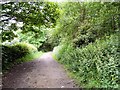
Footpath at Micklehurst
Along a former railway line.
Image: © Gerald England
Taken: 22 Jun 2009
0.16 miles
5
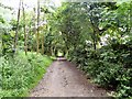
Footpath at Micklehurst
Along a former railway line.
Image: © Gerald England
Taken: 22 Jun 2009
0.16 miles
6
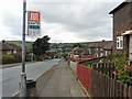
Winterford Road
Looking down towards Mossley.
Image: © Gerald England
Taken: 12 Aug 2009
0.16 miles
7
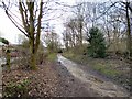
Footpath at Micklehurst
Footpath along the route of the former Micklehurst Loop line.
The Micklehurst Loop was constructed by the LNWR in 1881 and opened in 1886. The passenger service only lasted until 1907. The line closed completely in 1966 apart from coal traffic as far as the Hartshead Power Station at Heyrod which continued until 1972. More information with maps and photographs can be found at http://www.table38.steamrailways.com/rail/Micklehurst/micklehurst.htm (Steam Railways) and http://www.disused-stations.org.uk/m/micklehurst/ (Disused Stations)
Image: © Gerald England
Taken: 18 Feb 2016
0.17 miles
8
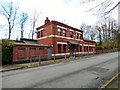
Station House
Micklehurst Station stood on the Micklehurst Loop constructed by the LNWR in 1881 and opened in 1886. The passenger service only lasted until 1907. The line closed completely in 1966 apart from coal traffic as far as the Hartshead Power Station at Heyrod which continued until 1972. More information with maps and photographs can be found at http://www.table38.steamrailways.com/rail/Micklehurst/micklehurst.htm (Steam Railways) and http://www.disused-stations.org.uk/m/micklehurst/ (Disused Stations)
Image: © Gerald England
Taken: 18 Feb 2016
0.18 miles
9
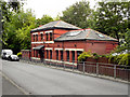
Former Station Building, Micklehurst
The former Micklehurst Station building on Station Road, Micklehurst.
Image: © David Dixon
Taken: 14 Jun 2011
0.18 miles
10
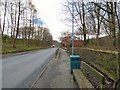
Station Road, Micklehurst
Micklehurst Station stood on the Micklehurst Loop constructed by the LNWR in 1881 and opened in 1886. The passenger service only lasted until 1907. The line closed completely in 1966 apart from coal traffic as far as the Hartshead Power Station at Heyrod which continued until 1972. More information with maps and photographs can be found at http://www.table38.steamrailways.com/rail/Micklehurst/micklehurst.htm (Steam Railways) and http://www.disused-stations.org.uk/m/micklehurst/ (Disused Stations)
Image: © Gerald England
Taken: 18 Feb 2016
0.18 miles