
IMAGES TAKEN NEAR TO
Tamebank, ASHTON-UNDER-LYNE, OL5 9BY
Introduction
This page details the photographs taken nearby to Tamebank, OL5 9BY by members of the Geograph project.
The Geograph project started in 2005 with the aim of publishing, organising and preserving representative images for every square kilometre of Great Britain, Ireland and the Isle of Man.

There are currently over 7.5m images from over14,400 individuals and you can help contribute to the project by visiting https://www.geograph.org.uk
Image Map
Images are licensed for reuse under creativecommons.org/licenses/by-sa/2.0
Notes
- Clicking on the map will re-center to the selected point.
- The higher the marker number, the further away the image location is from the centre of the postcode.
Image Listing (91 Images Found)
Images are licensed for reuse under creativecommons.org/licenses/by-sa/2.0
Image
Details
Distance
1
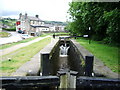
"Roaches Lock"
Looking along the narrow lock towards Huddersfield, with the "Roaches Lock" public house in the background
Image: © Alexander P Kapp
Taken: 28 Jun 2007
0.02 miles
3
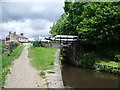
Huddersfield Narrow Canal
Southern lock gate of "Roaches Lock" on the Huddersfield Narrow Canal
Image: © Alexander P Kapp
Taken: 28 Jun 2007
0.02 miles
5
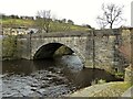
Roaches Bridge
Carries Manchester Road over the River Tame
Image: © Kevin Waterhouse
Taken: 19 Mar 2023
0.03 miles
6
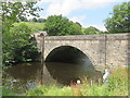
Tame Bridge
Bridge carrying Manchester Road (the A635) over the River Tame near Roaches Lock (on the Huddersfield narrow Canal).
Image: © Richard Rogerson
Taken: 9 Jul 2017
0.03 miles
7
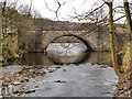
River Tame, Roaches Bridge
Roaches Bridge carries the A635, Manchester Road, over the River Tame at Roaches.
Image: © David Dixon
Taken: 17 Mar 2013
0.03 miles
8
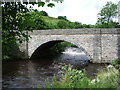
Road bridge
Bridge which carries the A635 over the River Tame at Roaches
Image: © Alexander P Kapp
Taken: 28 Jun 2007
0.03 miles
10
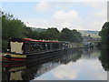
Huddersfield Narrow canal near Roaches
The Huddersfield Narrow Canal runs for 20 miles between Huddersfield in West Yorkshire and Ashton under Lyne in Greater Manchester, UK. The summit of the Huddersfield Narrow Canal is the highest navigable waterway in Britain. Standedge Tunnel on the Huddersfield Narrow Canal is Britain's longest canal tunnel. The canal has a total of 74 locks. The Huddersfield Narrow Canal was fully opened in 1811 but was abandoned in the 1950s. It links the southern end of the Huddersfield Broad Canal, just north of Kings Mill, with the Ashton and Peak Forest Canals at Ashton under Lyne on the Lancashire side of the Pennines. The Huddersfield Narrow Canal re-opened to navigation in May 2001. http://www.penninewaterways.co.uk/index.htm
The Huddersfield Narrow Canal should not be confused with the Huddersfield Broad Canal which runs between the centre of Huddersfield and the Calder and Hebble Navigation at Cooper Bridge.
Image: © Richard Rogerson
Taken: 9 Jul 2017
0.03 miles