
IMAGES TAKEN NEAR TO
Stoneswood Drive, ASHTON-UNDER-LYNE, OL5 0BW
Introduction
This page details the photographs taken nearby to Stoneswood Drive, OL5 0BW by members of the Geograph project.
The Geograph project started in 2005 with the aim of publishing, organising and preserving representative images for every square kilometre of Great Britain, Ireland and the Isle of Man.

There are currently over 7.5m images from over14,400 individuals and you can help contribute to the project by visiting https://www.geograph.org.uk
Image Map
Images are licensed for reuse under creativecommons.org/licenses/by-sa/2.0
Notes
- Clicking on the map will re-center to the selected point.
- The higher the marker number, the further away the image location is from the centre of the postcode.
Image Listing (81 Images Found)
Images are licensed for reuse under creativecommons.org/licenses/by-sa/2.0
Image
Details
Distance
1
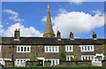
Quickwood, at Roughtown, Mossley
The cottages in the foreground date from the mid-eighteenth century. To their rear is the tower of St. John's Church which was opened in 1878.
Image: © Michael Fox
Taken: 15 Aug 2011
0.05 miles
2
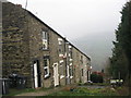
Dane Street Mossley
Taken on a misty March morning this picture shows the row of terraced houses that are located on Dane Street, which isn't really a street it's just a steep hill with no vehicular access.
For future reference the two bedroom terrace house at the bottom of the hill was on the market for £145,000 in March 2007
Image: © Paul Anderson
Taken: 30 Mar 2007
0.05 miles
3
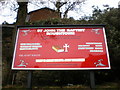
St John the Baptist Church, Roughtown, Sign
Image: © Alexander P Kapp
Taken: 9 Feb 2009
0.05 miles
4
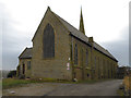
Church of St John the Baptist, Roughtown
The Church of St John the Baptist, at Roughtown, was opened in 1878 (http://www.saddleworth-historical-society.org.uk/overview/overview.htm - Saddleworth Historical Society).
Image: © David Dixon
Taken: 12 Dec 2011
0.05 miles
5
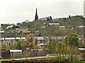
Looking up to Quickwood
From the towpath on the Huddersfield Narrow Canal. At the top of the hill is the Church of St John the Baptist
Image: © Graham Hogg
Taken: 18 Mar 2019
0.05 miles
6
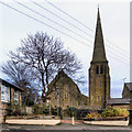
St John the Baptist Church, Roughtown
The Church of St John the Baptist, at Roughtown, was opened in 1878 (http://www.saddleworth-historical-society.org.uk/overview/overview.htm - Saddleworth Historical Society).
Image: © David Dixon
Taken: 12 Dec 2011
0.05 miles
7
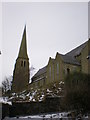
St John the Baptist Church, Roughtown
Image: © Alexander P Kapp
Taken: 9 Feb 2009
0.05 miles
8
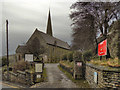
The Church of St John the Baptist, Roughtown
The entrance to St John's Church from Carrhill Road.
The Church of St John the Baptist, at Roughtown, was opened in 1878 (http://www.saddleworth-historical-society.org.uk/overview/overview.htm - Saddleworth Historical Society).
Image: © David Dixon
Taken: 12 Dec 2011
0.05 miles
9
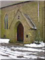
St John the Baptist Church, Roughtown, Porch
Image: © Alexander P Kapp
Taken: 9 Feb 2009
0.05 miles
10
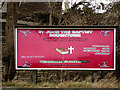
St John's Church Sign
The board outside the Church of St John the Baptist at Roughtown (Image]).
Image: © David Dixon
Taken: 12 Dec 2011
0.06 miles