1
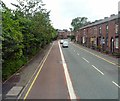
Lees Road, Salem
As the A669 climbs out of Lees towards Oldham, a bus lane is provided on the Oldham bound side.
Image: © Gerald England
Taken: 3 Jul 2013
0.01 miles
2
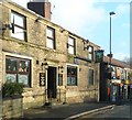
Friendship Inn
The Friendship Inn on Lees Road, Salem, Oldham.
Image: © David Dixon
Taken: 13 Oct 2011
0.02 miles
3
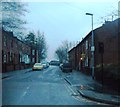
Salem
Looking east down the A669 Lees Road, Salem, Oldham. Lees Church is right of centre and Lydgate Church is visible on the horizon.
Image: © Martin Clark
Taken: Unknown
0.02 miles
4
Terraced housing on Lees Road
Image: © Raymond Knapman
Taken: 20 Jul 2012
0.02 miles
5
Friendship Inn
Image: © Anthony Parkes
Taken: 21 Dec 2013
0.05 miles
6
Salem Moravian Church, Lees Road
A late twentieth century building which replaced the original Moravian church in Clarksfield, Oldham. According to this http://en.wikipedia.org/wiki/Salem_Moravian_Church , on Wikipedia, the original church here was founded in 1825 by Brother John Lees, a prosperous member of the Fairfield Moravian (http://www.geograph.org.uk/snippet/1336 ) congregation.
Image: © David Dixon
Taken: 13 Oct 2011
0.07 miles
7
Sett Mill, Salem (Sett), Oldham
The Sett Mill stood on Gibraltar Street, Oldham, it was also known as the Gibraltar Mill. Built around 1838 it was demolished in the early 1980's and the site used for houses.
Image: © M Campbell
Taken: Unknown
0.08 miles
8
Lighthouse Inn
The Lighthouse Inn at the corner of Lees Road and Ogden Street.
Image: © David Dixon
Taken: 13 Oct 2011
0.08 miles
9
Clarksfield Street, Lees
Image: © Anthony Parkes
Taken: 13 Dec 2013
0.11 miles
10
Bank Top Mill, Edmund Street, Oldham
The Bank Top Mill was built in 1875. When I took the photograph it was owned by Newroyds. The low buildings in front of the Bank Top are on the site of the Clarksfield Mill. Wellyhole Street, a former Roman road, runs up the centre of the photograph. The Windsor Mill, formerly the Egyptian Mill built about 1836, is across Wellyhole St from the Bank Top. It ended its days as a warehouse for Newroyds. Houses now stand on the sites of all three mills.
Image: © M Campbell
Taken: Unknown
0.13 miles


