IMAGES TAKEN NEAR TO
Burnedge Lane, OLDHAM, OL4 4EA
Introduction
This page details the photographs taken nearby to Burnedge Lane, OL4 4EA by members of the Geograph project.
The Geograph project started in 2005 with the aim of publishing, organising and preserving representative images for every square kilometre of Great Britain, Ireland and the Isle of Man.

There are currently over 7.5m images from over14,400 individuals and you can help contribute to the project by visiting https://www.geograph.org.uk
Image Map
Images are licensed for reuse under creativecommons.org/licenses/by-sa/2.0
Notes
- Clicking on the map will re-center to the selected point.
- The higher the marker number, the further away the image location is from the centre of the postcode.
Image Listing (10 Images Found)
Images are licensed for reuse under creativecommons.org/licenses/by-sa/2.0
Image
Details
Distance
1
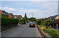
Burnedge Lane, Grasscroft
This is the top edge of the residential area. The mast on Wharmton is visible beyond.
Image: © Bill Boaden
Taken: 30 Jun 2010
0.05 miles
2
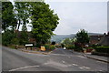
A road with a view
This is Summershades Lane where it leaves Burnedge Lane. It has views towards Dovestones and the Chew valley.
Image: © Bill Boaden
Taken: 30 Jun 2010
0.10 miles
3
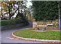
Lovers Lane, Grasscroft
The seat is at the junction of Burnedge Lane and Lovers Lane. But don't come up here looking for love - after the steep climb from Greenfield you'll be fit for nothing.
Image: © michael ely
Taken: 3 Nov 2007
0.12 miles
4
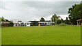
Lydgate Primary School
On Burnedge Lane
Image: © Kevin Waterhouse
Taken: 7 Jul 2024
0.17 miles
5
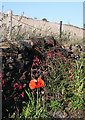
Road side planting on Burnedge Lane
Almost into October and an oriental poppy in flower. They normally bloom in May in this part of the country. A combination of a hot,dry spring, a wet, cool summer and now a warm autumn has confused the flora.
Image: © michael ely
Taken: 29 Sep 2011
0.18 miles
6
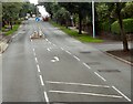
Oldham Road, Grasscroft
The A669 at the junction with Clough Road (left) and Lovers Lane (right).
Image: © Gerald England
Taken: 3 Jul 2013
0.21 miles
7
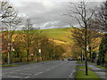
Grasscroft, Oldham Road
Looking eastwards along Oldham Road (A669), towards the telecommunications mast on Wharmton Hill.
Image: © David Dixon
Taken: 12 Dec 2011
0.21 miles
8
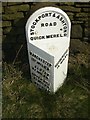
Old Milestone by Platting Road, Saddleworth Parish
Metal plate attached to stone post by the UC road, in parish of SADDLEWORTH (OLDHAM District), Platting Road, Lydgate; South of entrance to Load Hill Farm, 100m North of Grotton Hall, on the verge 100m from '30' sign, on East side of road. Brayshaw & Booth iron casting, erected by the County Council in the 19th century.
Inscription reads:- : MANCHESTER / 10½ MILES / ASHTON / 4¾ MILES / UPPER MILL / 2½ MILES / MOSSLEY / 2½ MILES : : STOCKPORT & ASHTON / ROAD / QUICK MERE LD : : HUDDERSFIELD / 15 MILES : : BRAYSHAW & BOOTH / MAKERS / LIVERSEDGE. :
Milestone Society National ID: YW_SRAS04.
Image: © C Minto
Taken: 5 Oct 2004
0.22 miles