
IMAGES TAKEN NEAR TO
High Street, OLDHAM, OL4 3BH
Introduction
This page details the photographs taken nearby to High Street, OL4 3BH by members of the Geograph project.
The Geograph project started in 2005 with the aim of publishing, organising and preserving representative images for every square kilometre of Great Britain, Ireland and the Isle of Man.

There are currently over 7.5m images from over14,400 individuals and you can help contribute to the project by visiting https://www.geograph.org.uk
Image Map
Images are licensed for reuse under creativecommons.org/licenses/by-sa/2.0
Notes
- Clicking on the map will re-center to the selected point.
- The higher the marker number, the further away the image location is from the centre of the postcode.
Image Listing (65 Images Found)
Images are licensed for reuse under creativecommons.org/licenses/by-sa/2.0
Image
Details
Distance
1
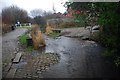
Brook Lane Ford, Lees
This ford on the River Medlock is found just off the A669 on Brook Lane in Lees.
Image: © John Walton
Taken: 19 Jan 2014
0.03 miles
2
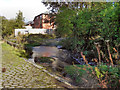
River Medlock
The ford where Brook Lane crosses the River Medlock at Leesbrook Nature Park.
Image: © David Dixon
Taken: 13 Oct 2011
0.03 miles
3
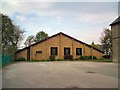
St Edwards R.C. Church
New Roman Catholic Church built in the grounds of the former church and school now the Parish Hall.
Church website: http://www.saintedwards.co.uk/
Image: © Gerald England
Taken: 2 May 2012
0.03 miles
4
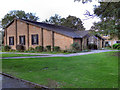
St Edwards' Roman Catholic Church, Lees
This late twentieth century building replaced an earlier church, badly damaged by fire. (Church web site http://www.saintedwards.co.uk/history.htm )
Image: © David Dixon
Taken: 13 Oct 2011
0.04 miles
5
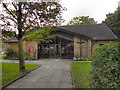
St Edwards' Roman Catholic Church, Lees
This late twentieth century building on Spring Lane, replaced an earlier church which was badly damaged by a fire. (Church web site http://www.saintedwards.co.uk/history.htm )
Image: © David Dixon
Taken: 13 Oct 2011
0.04 miles
6
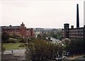
Athens Mill, Brook Lane, Lees
The Athens Mill on the left of the photograph was built in 1905 on the site of the Medlock Mill. In the 1960s it was used for storing tractors. The top floor shows fire damage.
Behind the Athens stands the Owl Mill on New St, Lees. It was built in 1898 and when I took the photograph was owned by Newroyd
In the middle of the photograph is the Acorn Mill on Mellor St. Formerly Hey Lane Mill, it is now flats.
On the horizon at the right is Rome Mill, Walker St, Springhead. The site is now houses.
Image: © M Campbell
Taken: Unknown
0.04 miles
7
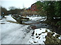
Brookside as it fords the River Medlock
Image: © Alexander P Kapp
Taken: 12 Feb 2009
0.04 miles
8
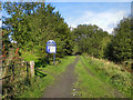
Leesbrook Nature Park
The path into Leesbrook Nature Park, from Brook Lane.
Image: © David Dixon
Taken: 13 Oct 2011
0.05 miles
9
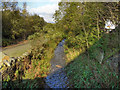
River Medlock, Leesbrook
The River Medlock, running alongside Brook Lane.
Image: © David Dixon
Taken: 13 Oct 2011
0.05 miles
10
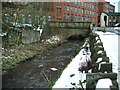
Lees Bridge
Carries the A669 over the River Medlock
Image: © Alexander P Kapp
Taken: 12 Feb 2009
0.05 miles