
IMAGES TAKEN NEAR TO
Grove Terrace, OLDHAM, OL4 2TB
Introduction
This page details the photographs taken nearby to Grove Terrace, OL4 2TB by members of the Geograph project.
The Geograph project started in 2005 with the aim of publishing, organising and preserving representative images for every square kilometre of Great Britain, Ireland and the Isle of Man.

There are currently over 7.5m images from over14,400 individuals and you can help contribute to the project by visiting https://www.geograph.org.uk
Image Map
Images are licensed for reuse under creativecommons.org/licenses/by-sa/2.0
Notes
- Clicking on the map will re-center to the selected point.
- The higher the marker number, the further away the image location is from the centre of the postcode.
Image Listing (48 Images Found)
Images are licensed for reuse under creativecommons.org/licenses/by-sa/2.0
Image
Details
Distance
1
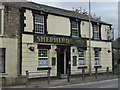
Shepherds Boy, Waterhead
A pub on the corner of Huddersfield Road (A62) and Sidebottom Street.
Image: © michael ely
Taken: 25 Aug 2008
0.02 miles
2
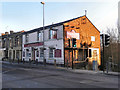
Shepherds Boy
The Shepherds Boy public house on Huddersfield Road, Waterhead.
Image: © David Dixon
Taken: 28 Jan 2011
0.03 miles
3
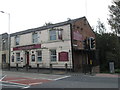
Shepherds Boy public house at Waterhead
Image: © John Slater
Taken: 29 Sep 2014
0.04 miles
4
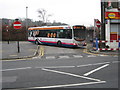
Waterhead Bus Terminus
This is the turning point at Waterhead for buses from Manchester and Oldham.
Image: © Paul Anderson
Taken: 18 Dec 2006
0.04 miles
6

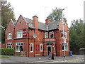
Waterhead, shops
Off Culvert Road, off Huddersfield Road; a short parade, with post office, bakery and café, hair salon and card shop.
Image: © Mike Faherty
Taken: 17 Oct 2009
0.06 miles
7
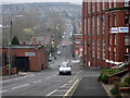
Greenacres Road Waterhead
With the Orme and Cairo Mills to the right of the picture, this is Greenacres Road looking down hill towards Image in the distance.
Image: © Paul Anderson
Taken: 30 Mar 2007
0.06 miles
8
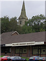
Village Manor Bakery, Waterhead
Part of a parade of shops on the corner of Huddersfield Road (A62) and Culvert Street.
Image: © michael ely
Taken: 25 Aug 2008
0.07 miles
9
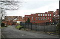
Majestic, Orme & Cairo Mills
In that order, left to right. The white scar on Majestic is where the engine house once was. The tall arched window on the left of Orme is the window of the tall engine house that once housed a 1250 horsepower inverted vertical triple expansion steam engine by George Saxon. This was built in 1911 and according to Arthur Roberts was 21", 33" & 51" x 4' stroke with a 22' flywheel grooved for 35 cotton driving ropes.
According to Gurr and Hunt, Orme was built 1908 and in 1915 had 62,000 ring spindles. The architect was F W Dixon & Son. The engine stopped 1-3-1960 and the mill closed the following year. Now used by Ferranti as ITEC training centre and warehouse.
Image: © Chris Allen
Taken: 13 Feb 2010
0.07 miles
10
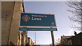
Welcome to Lees
A boundary sign welcoming folk to the suburban village of Lees in the Metropolitan Borough of Oldham, Greater Manchester, England. This particular sign is located along the A62 road, and lies along the historic and conventional boundary between the town of Oldham and village of Lees.
The emblem on the welcome sign consists of St Edward's Crown surmounted upon a golden wreath; the date of 1894 refers to the year that Lees was incorporated as the Lees Urban District of Lancashire.
Image: © Steven Haslington
Taken: 28 Oct 2011
0.07 miles