
IMAGES TAKEN NEAR TO
Counthill Road, OLDHAM, OL4 2PE
Introduction
This page details the photographs taken nearby to Counthill Road, OL4 2PE by members of the Geograph project.
The Geograph project started in 2005 with the aim of publishing, organising and preserving representative images for every square kilometre of Great Britain, Ireland and the Isle of Man.

There are currently over 7.5m images from over14,400 individuals and you can help contribute to the project by visiting https://www.geograph.org.uk
Image Map
Images are licensed for reuse under creativecommons.org/licenses/by-sa/2.0
Notes
- Clicking on the map will re-center to the selected point.
- The higher the marker number, the further away the image location is from the centre of the postcode.
Image Listing (12 Images Found)
Images are licensed for reuse under creativecommons.org/licenses/by-sa/2.0
Image
Details
Distance
1
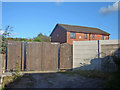
Watersheddings, former home of the Roughyeds
This used to be the entrance to Oldham Rugby League Club's ground at Watersheddings before the ground was sold for housing development. An example of the new housing can be seen beyond the perimeter fence.
Image: © michael ely
Taken: 17 Oct 2007
0.11 miles
2
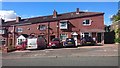
Furze Lane, Watersheddings
Houses on the hillside of Furze Lane in the Watersheddings area of Oldham, Greater Manchester.
Image: © Steven Haslington
Taken: 2 Oct 2016
0.12 miles
3
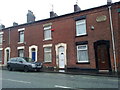
Beaconsfield Terrace on Ripponden Road, Oldham
Beaconsfield Terrace, a row of red-brick terraced houses centred on 330 Ripponden Road (the A672) in the Watershedding area of Oldham, Greater Manchester. This particular row was constructed in 1885 and is typical of the housing stock of much of Oldham and much of Greater Manchester.
Image: © Steven Haslington
Taken: 30 May 2011
0.13 miles
5

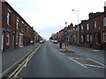
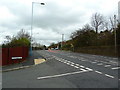
Ripponden Road (A672), Watersheddings
Looking along Ripponden Road, from the junction with Radcliffe Road.
Image: © David Dixon
Taken: 28 Jan 2011
0.17 miles
6
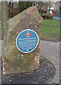
Memorial Plaque
Plaque remembering Watersheddings, the home of Oldham RLFC for 108 years. It is located in a tiny public park at the junction of Ripponden Road and Counthill Road.
Image: © michael ely
Taken: 24 Mar 2008
0.17 miles
8
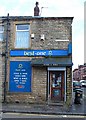
Corner Shop
On the corner of Counthill Road and Watersheddings Street.
Image: © michael ely
Taken: 24 Mar 2008
0.19 miles

10
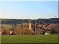
Religious Conversion
Watersheddings used to be the traditional seat of Rugby League in Oldham, but the team now share a ground with Oldham Athletic F.C. at Boundary Park. This amateur-league pitch near the original location is home to Waterhead ARLFC. The church spire is in an adjacent square at Waterhead.
Image: © Roger May
Taken: 18 Nov 2005
0.23 miles