IMAGES TAKEN NEAR TO
Hollymount Drive, OLDHAM, OL4 2NF
Introduction
This page details the photographs taken nearby to Hollymount Drive, OL4 2NF by members of the Geograph project.
The Geograph project started in 2005 with the aim of publishing, organising and preserving representative images for every square kilometre of Great Britain, Ireland and the Isle of Man.

There are currently over 7.5m images from over14,400 individuals and you can help contribute to the project by visiting https://www.geograph.org.uk
Image Map
Images are licensed for reuse under creativecommons.org/licenses/by-sa/2.0
Notes
- Clicking on the map will re-center to the selected point.
- The higher the marker number, the further away the image location is from the centre of the postcode.
Image Listing (32 Images Found)
Images are licensed for reuse under creativecommons.org/licenses/by-sa/2.0
Image
Details
Distance
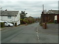
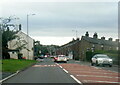
3
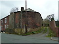
Building off Turf Pit Lane, Moorside
Image: © Alexander P Kapp
Taken: 14 Nov 2012
0.06 miles
4
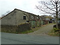
Building off Turf Pit Lane, Moorside
Image: © Alexander P Kapp
Taken: 14 Nov 2012
0.07 miles
5
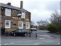
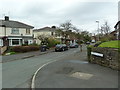
Bulls Head Tavern, Sholver
Situated on the A672, Ripponden Road, opposite its junction with Sholver Lane.
Image: © michael ely
Taken: 25 Feb 2007
0.07 miles
7
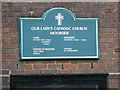
Our Lady's Catholic Church, Moorside, Nameboard
Image: © Alexander P Kapp
Taken: 14 Nov 2012
0.08 miles
8
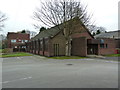
Our Lady's Catholic Church, Moorside
Image: © Alexander P Kapp
Taken: 14 Nov 2012
0.09 miles
10
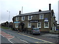
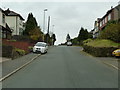
Bulls Head Tavern, Moorside
On Ripponden Road (A672).
Image: © JThomas
Taken: 14 Mar 2015
0.09 miles