
IMAGES TAKEN NEAR TO
Churchill Street, OLDHAM, OL4 1RP
Introduction
This page details the photographs taken nearby to Churchill Street, OL4 1RP by members of the Geograph project.
The Geograph project started in 2005 with the aim of publishing, organising and preserving representative images for every square kilometre of Great Britain, Ireland and the Isle of Man.

There are currently over 7.5m images from over14,400 individuals and you can help contribute to the project by visiting https://www.geograph.org.uk
Image Map
Images are licensed for reuse under creativecommons.org/licenses/by-sa/2.0
Notes
- Clicking on the map will re-center to the selected point.
- The higher the marker number, the further away the image location is from the centre of the postcode.
Image Listing (71 Images Found)
Images are licensed for reuse under creativecommons.org/licenses/by-sa/2.0
Image
Details
Distance
3
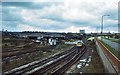
Oldham railway parcels depot 1978
Oldham's "parcels concentration depot" in 1978, with an Oldham-Manchester train passing Oldham Mumps signalbox. Of the railway features and land in the photo, only the two foreground lines survive, plus the signalbox, surrounded on all sides by redevelopment. The depot is now the site of a retail park. Oldham by-pass to the right.
Image: © Peter Whatley
Taken: Unknown
0.08 miles
4
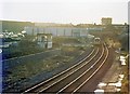
Oldham Mumps signalbox and former parcels depot 1989
Looking from the Oldham bypass, railway land is fast being reclaimed by light industrial uses. The former parcels collection depot site featured ELS' furniture store by 1989.
Image: © Peter Whatley
Taken: 14 Jan 1989
0.11 miles
5
Oldham parcels depot
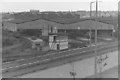
This extremely large depot was constructed in the early 1960s as part of a UK-wide plan to concentrate railway parcels traffic on a small number of purpose-built, conceptually high-efficiency depots. The plan failed due to road transport's inherent advantages of flexibility and point-to-point efficiency. Oldham's depot was still operational into the late 1970s, but no trace now remains of it, redevelopment having comprehensively changed the area. Oldham Mumps signalbox remains, but is hemmed in by new development.
Image: © Peter Whatley
Taken: Unknown
0.11 miles
6
Barlow Street Oldham
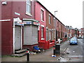
Shop not open all hours!http://news.bbc.co.uk/1/hi/uk/5014448.stm
Image: © Paul Anderson
Taken: 6 Jan 2007
0.12 miles
7
Pitt Street Oldham
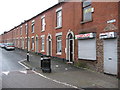
A row of terraced houses which are very familiar with this area of Oldham.
Mohammed Ansar of Glodwick's Pakistani community centre says that even after the troubles of 2001, they still do not have the resources to deal with the deprivation in the area click on http://news.bbc.co.uk/1/hi/uk/5014448.stm
Image: © Paul Anderson
Taken: 6 Jan 2007
0.12 miles
8
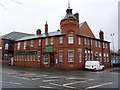
Oldham Deaf Society, Park Road, Oldham
Image: © Alexander P Kapp
Taken: 2 Feb 2010
0.14 miles
9
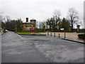
Entrance to Alexandra Park
With Queens Road to the right
Image: © Alexander P Kapp
Taken: 2 Feb 2010
0.14 miles
10
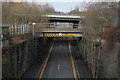
Waterloo Street bridges
The higher bridge carries the Oldham Way (A62) round the town centre. The lower bridge carries - just for a few days more - the Metrolink tram line, formerly the ex-Lancashire and Yorkshire Railway line from Manchester to Rochdale via Oldham. The empty abutments carried the parallel Great Central and London and North Western Railways' joint line with links to Ashton-under-Lyne and Greenfield. The footbridge from which the view is taken is on the site of yet another bridge which carried railway sidings.
Image: © Alan Murray-Rust
Taken: 7 Jan 2014
0.14 miles