
IMAGES TAKEN NEAR TO
Bridson Street, OLDHAM, OL4 1NW
Introduction
This page details the photographs taken nearby to Bridson Street, OL4 1NW by members of the Geograph project.
The Geograph project started in 2005 with the aim of publishing, organising and preserving representative images for every square kilometre of Great Britain, Ireland and the Isle of Man.

There are currently over 7.5m images from over14,400 individuals and you can help contribute to the project by visiting https://www.geograph.org.uk
Image Map
Images are licensed for reuse under creativecommons.org/licenses/by-sa/2.0
Notes
- Clicking on the map will re-center to the selected point.
- The higher the marker number, the further away the image location is from the centre of the postcode.
Image Listing (16 Images Found)
Images are licensed for reuse under creativecommons.org/licenses/by-sa/2.0
Image
Details
Distance
2
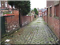
Rear of Tynwald Street Clarksfield
There are still plenty of cobbled back lanes in the Oldham area Image
Image: © Paul Anderson
Taken: 6 Jan 2007
0.06 miles
4
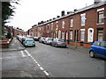
Hollinhall Street Oldham
A very typical row of terraced houses which are a familiar sight in the Oldham area.
Image: © Paul Anderson
Taken: 6 Jan 2007
0.15 miles
5
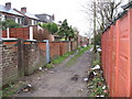
Rear of Hollinhall Street Oldham
This is typical of the rear access to most of the terraced houses in this area of Oldham
Image: © Paul Anderson
Taken: 6 Jan 2007
0.15 miles
6
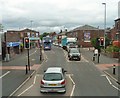
Lees Road, Clarksfield
The A669 approaching the junction with Balfour Street.
Image: © Gerald England
Taken: 3 Jul 2013
0.15 miles
7
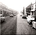
Clarksfield Road
Superior terraced housing with "bay windows"!
Image: © Gerald England
Taken: Unknown
0.18 miles

9
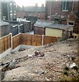
Clarksfield Allotment
Allotment off Clarksfield Road on land belonging to Clarksfield Tennis Club. Not long after the land was sold for housing.
Image: © Gerald England
Taken: Unknown
0.18 miles
10

Cycle route following line of former railway
This view across Cranbrook Street just off the path shows the route is on the top of infill, since only the bridge parapet is visible of the former railway bridge. The path is on the former Oldham to Greenfield line.
Image: © Kevin Waterhouse
Taken: 10 Feb 2023
0.18 miles