IMAGES TAKEN NEAR TO
Greengate Street, OLDHAM, OL4 1DG
Introduction
This page details the photographs taken nearby to Greengate Street, OL4 1DG by members of the Geograph project.
The Geograph project started in 2005 with the aim of publishing, organising and preserving representative images for every square kilometre of Great Britain, Ireland and the Isle of Man.

There are currently over 7.5m images from over14,400 individuals and you can help contribute to the project by visiting https://www.geograph.org.uk
Image Map
Images are licensed for reuse under creativecommons.org/licenses/by-sa/2.0
Notes
- Clicking on the map will re-center to the selected point.
- The higher the marker number, the further away the image location is from the centre of the postcode.
Image Listing (85 Images Found)
Images are licensed for reuse under creativecommons.org/licenses/by-sa/2.0
Image
Details
Distance
2
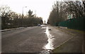
Oldham Glodwick Road railway station (site), Greater Manchester
Opened in 1856 by the London & North Western Railway on the branch line from Delph via Greenfield and Oldham to Guide Bridge, this station closed to passengers in 1955.
View east towards Lees and Greenfield. The station was in a cutting which has now been in-filled, but the course can still be traced to the pedestrian lights and between the trees beyond.
Image: © Nigel Thompson
Taken: 30 Dec 2013
0.08 miles
3
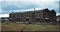
Railway cotton warehouse - Glodwick Road 1978
Image: © Peter Whatley
Taken: Unknown
0.10 miles
4
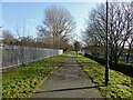
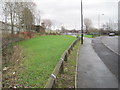
Cycle path following route of former railway
The path goes from Oldham to Grotton following the Oldham to Greenfield railway line. Much of the route is on infill such as here looking east from Glodwick Road, Oldham
Image: © Kevin Waterhouse
Taken: 9 Feb 2023
0.11 miles
5
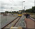
Oldham Mumps Tram Station
A tram bound for Rochdale has just left as round the bend approaches a tram bound for East Didsbury.
Image: © Gerald England
Taken: 3 Jul 2013
0.14 miles
6
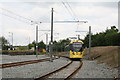
Oldham Mumps:Metrolink
Looking north. Car No 3028 has pulled north of the platforms and is about to return into the southbound platform to form a service to St. Werburgh's Road via Central Manchester. Service to and from Oldham Mumps began on Wednesday 13 June 2012. The terminus here is only temporary, and will be replaced by another some distance away, once the street-running section through Central Oldham has been completed in 2014.
Image: © Dr Neil Clifton
Taken: 26 Jun 2012
0.14 miles
7
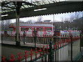
Red railway railings
Railings on Oldham Mumps station
Image: © R lee
Taken: 31 Jan 2009
0.15 miles
8
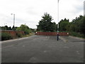
View North From Oldham Mumps Station
In its final days before closure and downgrading to a Metrolink tram service, the tight curve toward Rochdale is seen. The darker tarmac behind the lamp standard denotes the site of the bay platform for services to Royton.
Image: © Peter Whatley
Taken: 16 Sep 2009
0.15 miles
9
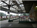
Oldham Mumps
Mumps station in Oldham.
Image: © Gerald England
Taken: 3 Sep 2008
0.15 miles