
IMAGES TAKEN NEAR TO
Lower Frenches Drive, OLDHAM, OL3 7JD
Introduction
This page details the photographs taken nearby to Lower Frenches Drive, OL3 7JD by members of the Geograph project.
The Geograph project started in 2005 with the aim of publishing, organising and preserving representative images for every square kilometre of Great Britain, Ireland and the Isle of Man.

There are currently over 7.5m images from over14,400 individuals and you can help contribute to the project by visiting https://www.geograph.org.uk
Image Map
Images are licensed for reuse under creativecommons.org/licenses/by-sa/2.0
Notes
- Clicking on the map will re-center to the selected point.
- The higher the marker number, the further away the image location is from the centre of the postcode.
Image Listing (138 Images Found)
Images are licensed for reuse under creativecommons.org/licenses/by-sa/2.0
Image
Details
Distance
1

Camouflaged electricity sub-station
This building, on the edge of a Wimpey housing estate, is designed to look like the other houses. The fence is the give-away.
Image: © David Watson
Taken: 8 Oct 2008
0.08 miles
2
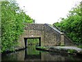
Frenches Bridge
Bridge no. 80 on the Huddersfield Narrow Canal. Taken from a narrowboat approaching the bridge.
Image: © Christine Johnstone
Taken: 18 May 2010
0.09 miles
3

The River Tame seen from Chew Valley Road (A669), Greenfield
Image: © habiloid
Taken: 6 Mar 2026
0.09 miles
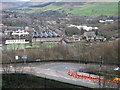
5
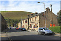
Chew Valley Road, Greenfield
The Wellington pub is on the right and Wharmton Hill beyond. Chew Valley Road originated in the first half of the nineteenth century as a branch of the main turnpike road between Oldham and Uppermill.
Image: © Michael Fox
Taken: 27 Sep 2011
0.09 miles
6
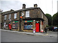
Greenfield Post Office
Corner of Chew Valley Road and Wilson Street.
Image: © John Topping
Taken: 5 Oct 2013
0.09 miles
7
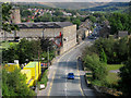
Wellington Road Greenfield
This is the main road through the centre of Greenfield.
The mill on the left is Image which is to be demolished
and a new Tesco store built in its place.
Image: © Paul Anderson
Taken: 15 Sep 2007
0.10 miles
8
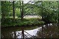
Greenfield Rugby Club
Seen from the Huddersfield Narrow Canal.
Image: © Bill Boaden
Taken: 29 May 2010
0.10 miles
10
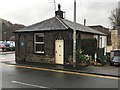
The Toll House
On Chew Valley Road, originally the Stanedge & Oldham turnpike road
Image: © Graham Hogg
Taken: 18 Mar 2019
0.10 miles