
IMAGES TAKEN NEAR TO
Ryefields Drive, OLDHAM, OL3 6BX
Introduction
This page details the photographs taken nearby to Ryefields Drive, OL3 6BX by members of the Geograph project.
The Geograph project started in 2005 with the aim of publishing, organising and preserving representative images for every square kilometre of Great Britain, Ireland and the Isle of Man.

There are currently over 7.5m images from over14,400 individuals and you can help contribute to the project by visiting https://www.geograph.org.uk
Image Map
Images are licensed for reuse under creativecommons.org/licenses/by-sa/2.0
Notes
- Clicking on the map will re-center to the selected point.
- The higher the marker number, the further away the image location is from the centre of the postcode.
Image Listing (108 Images Found)
Images are licensed for reuse under creativecommons.org/licenses/by-sa/2.0
Image
Details
Distance

2

Bus stop on High Street (A670), Uppermill
Looking north west.
Image: © JThomas
Taken: 8 Nov 2018
0.11 miles
3
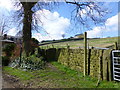
Waymarker for path to Brownhill Lane
Image: © Raymond Knapman
Taken: 1 Apr 2014
0.11 miles
4

Saddleworth Spiritualist Church
161 High Street (A670).
Image: © Peter Holmes
Taken: 5 Feb 2011
0.12 miles
5

Saddleworth Spiritualist Church
On High Street.
Image: © JThomas
Taken: 8 Nov 2018
0.12 miles
6

Old Boundary Marker by the A670, High Street, Uppermill, Saddleworth parish
Parish Boundary Marker by the A670, in parish of Saddleworth (Oldham District), Uppermill, High Street, 70m South of the junction with Dobcross New Road, just South of the viaduct, East side of road.
Inscription reads:-
B
U L B
BOUNDARY
Surveyed
Milestone Society National ID: YW_UPM01pb
Image: © Milestone Society
Taken: Unknown
0.13 miles
7
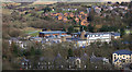
Saddleworth School
Originally a secondary modern then a comprehensive, this school was opened in 1961 on the site of a Council school. It has greatly expanded in size over the years.
Image: © Michael Fox
Taken: 25 Mar 2010
0.13 miles
8
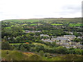
View east from Ladcastle Road
Looking east over Uppermill.
Image: © John Topping
Taken: 5 Oct 2013
0.13 miles
9
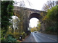
Saddleworth Viaduct
Spans the River Tame and the A670.
Looking north west.
Image: © JThomas
Taken: 8 Nov 2018
0.13 miles
10
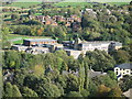
Saddleworth School Uppermill
Located just off the High Street in Uppermill 1275 pupils age 11-16 attend Saddleworth School.
Major success of 2004-5 was the judgement of the whole school by Ofsted in Feb 2005. It recognised the school as "good with several outstanding qualities".
The school premises are rather old and sometimes congested and require regular maintenance.
Nevertheless, the governors have been able to make major improvements to repairs, decor and parking and a brand new all-weather pitch was laid in August 2006.
For more information about the school click on http://www.saddleworth.oldham.sch.uk/
Image: © Paul Anderson
Taken: 29 Oct 2006
0.14 miles