IMAGES TAKEN NEAR TO
Mowhalls Lane, OLDHAM, OL3 5QU
Introduction
This page details the photographs taken nearby to Mowhalls Lane, OL3 5QU by members of the Geograph project.
The Geograph project started in 2005 with the aim of publishing, organising and preserving representative images for every square kilometre of Great Britain, Ireland and the Isle of Man.

There are currently over 7.5m images from over14,400 individuals and you can help contribute to the project by visiting https://www.geograph.org.uk
Image Map
Images are licensed for reuse under creativecommons.org/licenses/by-sa/2.0
Notes
- Clicking on the map will re-center to the selected point.
- The higher the marker number, the further away the image location is from the centre of the postcode.
Image Listing (114 Images Found)
Images are licensed for reuse under creativecommons.org/licenses/by-sa/2.0
Image
Details
Distance
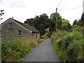
2
Mow Halls Lane/Ladcastle Road, Dobcross
Image: © John Topping
Taken: 5 Oct 2013
0.02 miles
3
Delph Donkey steps to Ladcastle road. Dobcross
Image: © Cheesemaster
Taken: 25 Apr 2008
0.05 miles
4
Steps down to Tame Valley Way
From Ladcastle Road to the old railway route (Delph Donkey route from Oldham).
Image: © John Topping
Taken: 5 Oct 2013
0.08 miles
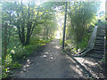
5
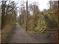
The Delph Donkey
Footpath on the dismantled Delph to Uppermill railway. The steps on the right lead up to Ladcastle Road
Image: © Alexander P Kapp
Taken: 24 Feb 2009
0.10 miles
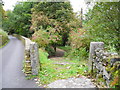
6
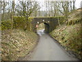
Railway bridge over Mow Halls Lane
Image: © Alexander P Kapp
Taken: 24 Feb 2009
0.10 miles
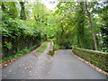
7
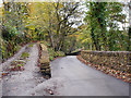
Mow Halls Lane
Mow Halls Lane, at Ladcastle
Image: © David Dixon
Taken: 28 Oct 2011
0.11 miles
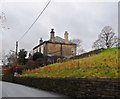
8
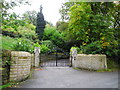
Ladcastle, Dobcross
Off Ladcastle Road.
Image: © John Topping
Taken: 5 Oct 2013
0.12 miles
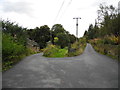
10
Spring Brow/Ladcastle Road junction, Dobcross
Image: © John Topping
Taken: 5 Oct 2013
0.13 miles