
IMAGES TAKEN NEAR TO
Ladcastle Road, OLDHAM, OL3 5QT
Introduction
This page details the photographs taken nearby to Ladcastle Road, OL3 5QT by members of the Geograph project.
The Geograph project started in 2005 with the aim of publishing, organising and preserving representative images for every square kilometre of Great Britain, Ireland and the Isle of Man.

There are currently over 7.5m images from over14,400 individuals and you can help contribute to the project by visiting https://www.geograph.org.uk
Image Map
Images are licensed for reuse under creativecommons.org/licenses/by-sa/2.0
Notes
- Clicking on the map will re-center to the selected point.
- The higher the marker number, the further away the image location is from the centre of the postcode.
Image Listing (57 Images Found)
Images are licensed for reuse under creativecommons.org/licenses/by-sa/2.0
Image
Details
Distance
2
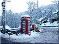
Phone Box on Ladcastle Road Dobcross
This old red telephone box,one of Britain's disappearing icons, is located at the junction of Ladcastle Road and Delph New Road in Dobcross. . BT – formerly known as British Telecom – has been in the process of phasing out the red phone box for a number of years now.
Image: © Paul Anderson
Taken: 23 Dec 2009
0.02 miles
3
New Bank Close, Tame Water/Dobcross
Viewed from Ladcastle Road.
Image: © John Topping
Taken: 5 Oct 2013
0.02 miles
4
A6052, Dobcross New Road
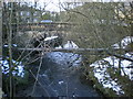
Tame Water, Dobcross.
Image: © John Topping
Taken: 5 Oct 2013
0.03 miles
6
Delph New Road, Dobcross
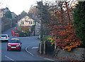
This is a shot of the A6052 that runs between Uppermill and Denshaw via Delph. It is taken from its junction with Ladcastle Road. The main road bends sharply to the right at this point
Image: © michael ely
Taken: 3 Nov 2007
0.05 miles
7
Stone trough
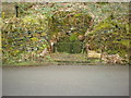
At the side of Ladcastle Road
Image: © Alexander P Kapp
Taken: 24 Feb 2009
0.06 miles
8

Information board
On the site of what was Dobcross Halt. http://www.geograph.org.uk/photo/1177870
Image: © Alexander P Kapp
Taken: 24 Feb 2009
0.06 miles
9

Information board (Detail)
Section of the board at the site of Dobcross Halt
Image: © Alexander P Kapp
Taken: 24 Feb 2009
0.06 miles
10

Delph Branch Line
This very low 8 foot high railway bridge in Dobcross used to carry the long gone branch line to Delph that closed in 1955.
The old track bed is now a popular recreational route between Image and Image for purposes such as cycling, walking and horse riding.
Although the railway infrastructure has mostly been removed, the architecture of the bridges, walls and buttresses remains. The route is also an important wildlife corridor with trees such as Silver Birch, Oak, Rowan, Willow and Hawthorn, together with several varieties of wildflowers, being visible along the route
Image: © Paul Anderson
Taken: 29 Oct 2006
0.07 miles