
IMAGES TAKEN NEAR TO
Moorland Avenue, OLDHAM, OL3 5QF
Introduction
This page details the photographs taken nearby to Moorland Avenue, OL3 5QF by members of the Geograph project.
The Geograph project started in 2005 with the aim of publishing, organising and preserving representative images for every square kilometre of Great Britain, Ireland and the Isle of Man.

There are currently over 7.5m images from over14,400 individuals and you can help contribute to the project by visiting https://www.geograph.org.uk
Image Map
Images are licensed for reuse under creativecommons.org/licenses/by-sa/2.0
Notes
- Clicking on the map will re-center to the selected point.
- The higher the marker number, the further away the image location is from the centre of the postcode.
Image Listing (20 Images Found)
Images are licensed for reuse under creativecommons.org/licenses/by-sa/2.0
Image
Details
Distance
1

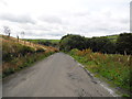
Moorland Avenue, Delph
Off Lark Hill Road.
Image: © John Topping
Taken: 5 Oct 2013
0.01 miles
2

Platt Lane Dobcross
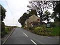
This detached cottage stands by the side of Platt Lane
between the villages of Delph and Dobcross in Saddleworth.
Note the bricked up window this is because in 1696 in the reign of William III another form of taxation came into force which was known as the “Window Tax” and would last until 1851.
The revenue derived from the tax in the first year of its levy amounted to £1,200,000
The tax would be paid on a house of more than six windows one way for a person to by pass the tax was to brick up one or two windows over the stated six, even today on many of the older houses around Saddleworth the bricked up windows are still there.
In 1792 houses with 7-9 windows had to pay a tax of 2 shillings (20p), and those people with property containing 10-19 windows would pay a tax of 4 shillings (40p).
In 1825 the number of windows taxable went from six to eight windows.
The Window Tax would be replaced in 1851 with a tax called House Duty.
http://en.wikipedia.org/wiki/Window_tax
Image: © Paul Anderson
Taken: 2 Jun 2007
0.05 miles
4
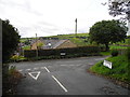
Platt Lane/Lark Hill Road junction, Dobcross
Image: © John Topping
Taken: 5 Oct 2013
0.06 miles
6
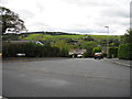
Bar Meadow, Dobcross
Viewed from Platt Lane.
Image: © John Topping
Taken: 5 Oct 2013
0.10 miles
7
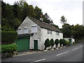
A white cottage, Platt Lane/Dobcross
Circa 1747.
Image: © John Topping
Taken: 5 Oct 2013
0.14 miles
8

Crib Lane, Dobcross
For future reference the one bedroom stone cottage on the left, with the for sale sign, was on the market for £175,000 in January 2009 http://www.thinkproperty.com/property/12184878
Image: © Alexander P Kapp
Taken: 30 Jan 2009
0.21 miles
9
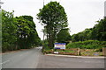
Delph New Road
Former buildings have gone, but as the sign suggests, there is always scope for new housing development.
Image: © Bill Boaden
Taken: 28 Jun 2010
0.22 miles
10

Crib Lane, Dobcross
The houses in the photograph are among a number of old dwellings standing by the lane which leads from Dobcross village towards Round Hill.
Image: © Michael Fox
Taken: 30 Jul 2011
0.22 miles