
IMAGES TAKEN NEAR TO
Carr Lane, OLDHAM, OL3 5ND
Introduction
This page details the photographs taken nearby to Carr Lane, OL3 5ND by members of the Geograph project.
The Geograph project started in 2005 with the aim of publishing, organising and preserving representative images for every square kilometre of Great Britain, Ireland and the Isle of Man.

There are currently over 7.5m images from over14,400 individuals and you can help contribute to the project by visiting https://www.geograph.org.uk
Image Map
Images are licensed for reuse under creativecommons.org/licenses/by-sa/2.0
Notes
- Clicking on the map will re-center to the selected point.
- The higher the marker number, the further away the image location is from the centre of the postcode.
Image Listing (14 Images Found)
Images are licensed for reuse under creativecommons.org/licenses/by-sa/2.0
Image
Details
Distance
2
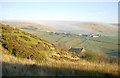
View from Hunters Hill, near Diggle
Looking eastwards from Hunters Hill, north of Diggle, across Harrop Ridge to Diggle Edge. The area is to the east of Oldham.
Image: © Martin Clark
Taken: Unknown
0.12 miles
3
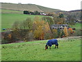
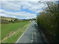
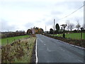
Grazing off Huddersfield Road, Diggle
View across a valley.
Image: © JThomas
Taken: 8 Nov 2018
0.14 miles
7

Old milestone
Another of the West Riding County Council milestones set up in 1893/94. This area was in the West Riding until 1974 when it was given away to greater Manchester. The milestone is on Standedge Road near tracks onto Harrop Edge. The milestone has been painted recently by members of a group in the Saddleworth area.
Right face - hidden in grass- STALYBRIDGE/7¼ MILES/OLDHAM/6¾ MILES/MOSSLEY/4½ MILES/UPPER MILL/1½ MILES
Milestone Society ID - YW_ODSD06
Image: © Chris Minto
Taken: 23 May 2026
0.18 miles
8
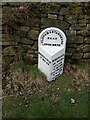
Old Milestone by the A670, Standedge Road, Diggle, Saddleworth Parish
Metal plate attached to stone post by the A670, in parish of SADDLEWORTH (OLDHAM District), Standedge Road, Diggle, 100m South of Carr Lane, just south of track onto Harrop Edge, on West side of road. Brayshaw & Booth iron casting, erected by the County Council in the 19th century.
Inscription reads:-
: HUDDERSFIELD / 12 MILES : : OLDHAM & STANDEDGE / ROAD / LORDSMERE : : MANCHESTER / 13¾ MILES / ASHTON / 7½ MILES / STALYBRIDGE / 7¼ MILES / OLDHAM / 6¾ MILES / (MOSSLEY / 4½ MILES / UPPER MILL / 1½ MILES) :
Maker:-
: BRAYSHAW & BOOTH / MAKERS / LIVERSEDGE :
Milestone Society National ID: YW_ODSD06.
Image: © C Minto
Taken: 5 Oct 2004
0.19 miles
9
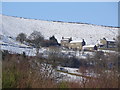
Cottages on the hillside above Diggle
Image: © Linden Milner
Taken: 31 Jan 2015
0.19 miles
10
Footpath to Ridge Lane
Off Huddersfield Road.
Image: © JThomas
Taken: 8 Nov 2018
0.20 miles