
IMAGES TAKEN NEAR TO
Butterhouse Lane, OLDHAM, OL3 5JN
Introduction
This page details the photographs taken nearby to Butterhouse Lane, OL3 5JN by members of the Geograph project.
The Geograph project started in 2005 with the aim of publishing, organising and preserving representative images for every square kilometre of Great Britain, Ireland and the Isle of Man.

There are currently over 7.5m images from over14,400 individuals and you can help contribute to the project by visiting https://www.geograph.org.uk
Image Map
Images are licensed for reuse under creativecommons.org/licenses/by-sa/2.0
Notes
- Clicking on the map will re-center to the selected point.
- The higher the marker number, the further away the image location is from the centre of the postcode.
Image Listing (72 Images Found)
Images are licensed for reuse under creativecommons.org/licenses/by-sa/2.0
Image
Details
Distance
1
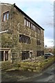
Lindum Cottage
Grade II listed weavers' cottage.
Image: © Dave Dunford
Taken: 2 Feb 2014
0.01 miles
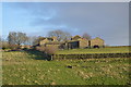
3
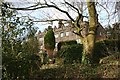
Ryefields House
Grade II listed house, late 18th century with its most noticeable feature the "early C19 coped parapet above an eaves band which has 6 niches below small gablets", to quote the official listing.
Image: © Dave Dunford
Taken: 2 Feb 2014
0.08 miles
4
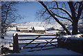
Ryefields Farm from Butterhouse
Saddleworth Church is in the distance.
Image: © Michael Fox
Taken: 30 Dec 1979
0.09 miles
5
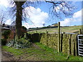
Waymarker for path to Brownhill Lane
Image: © Raymond Knapman
Taken: 1 Apr 2014
0.10 miles
7
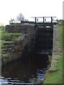
Lock 26W - Huddersfield Narrow Canal
12 Mile Lock - Diggle Flight
Image: © John M
Taken: 14 Oct 2012
0.12 miles
8
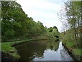
Pound between Locks 24W and 25W
A quiet morning on the Huddersfield Narrow Canal.
Image: © Christine Johnstone
Taken: 19 May 2010
0.12 miles
9
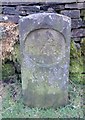
Canal Milemarker by the Huddersfield Narrow Canal, Holly Grove
Milemarker by the Huddersfield Narrow Canal, in parish of Saddleworth (Oldham District), Holly Grove, Diggle, by stone wall.
Inscription reads:-
12
Grade II listed.
List Entry Number: 1261754 https://historicengland.org.uk/listing/the-list/list-entry/1261754
Surveyed
Milestone Society National ID: HUN-12
Image: © Milestone Society
Taken: Unknown
0.12 miles
10
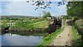
Lock No.26W (Twelve Mile Lock)
The bottom gate of the lock on the Huddersfield Narrow Canal
Image: © Kevin Waterhouse
Taken: 4 Jun 2021
0.13 miles