
IMAGES TAKEN NEAR TO
Beal Lane, OLDHAM, OL2 8UY
Introduction
This page details the photographs taken nearby to Beal Lane, OL2 8UY by members of the Geograph project.
The Geograph project started in 2005 with the aim of publishing, organising and preserving representative images for every square kilometre of Great Britain, Ireland and the Isle of Man.

There are currently over 7.5m images from over14,400 individuals and you can help contribute to the project by visiting https://www.geograph.org.uk
Image Map
Images are licensed for reuse under creativecommons.org/licenses/by-sa/2.0
Notes
- Clicking on the map will re-center to the selected point.
- The higher the marker number, the further away the image location is from the centre of the postcode.
Image Listing (199 Images Found)
Images are licensed for reuse under creativecommons.org/licenses/by-sa/2.0
Image
Details
Distance
2

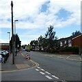
Shaw and Crompton station October 2009
The entrance to the old car park off Beal Lane now serves as the entry point for the Metrolink tram improvement works.
Image: © michael ely
Taken: 19 Oct 2009
0.02 miles
4
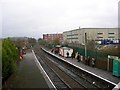
Shaw and Crompton Station
Commuters waiting for an Oldham bound train at Shaw and Crompton Station.
Image: © Keith Williamson
Taken: 1 Dec 2005
0.03 miles
5

All aboard!
An Oldham bound train about to leave Shaw and Crompton station.
Image: © Keith Williamson
Taken: 1 Dec 2005
0.03 miles
6

Rises Private Day Nursery
Founded in 2003. A mural on the outside is mostly obscured by parked cars, alas, and one section appears to have been damaged.
Image: © Gerald England
Taken: 19 Aug 2022
0.05 miles
7
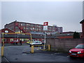
Shaw and Crompton railway station carpark
Looking out through the (former) exit from the carpark for Shaw and Crompton railway station, in Shaw and Crompton, Greater Manchester, England. This photograph was taken prior to both redevelopment work relating to the station's conversion to Greater Manchester's Metrolink system and before Dawn Mill (the red brick cotton mill in the distance) was demolished and replaced with an ASDA store.
Image: © Steven Haslington
Taken: 5 Mar 2004
0.05 miles
8
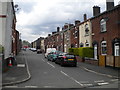
Travis Street, Shaw (1)
Looking towards Milnrow Road from Oak Street.
Image: © Richard Vince
Taken: 12 May 2018
0.05 miles
9
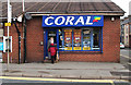
Betcha bippy!
An elderly couple call into the local bookies to collect their winnings. This is on Beal Lane.
Image: © michael ely
Taken: 20 Nov 2014
0.05 miles
10
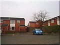
Gillemere Grove, Shaw and Crompton
Gillemere Grove in Shaw and Crompton, Greater Manchester. This housing estate was constructed in the mid-20th century and mostly consists of council stock.
Image: © Steven Haslington
Taken: 15 Mar 2011
0.06 miles