IMAGES TAKEN NEAR TO
Mount View Road, OLDHAM, OL2 8QE

Introduction

This page details the photographs taken nearby to Mount View Road, OL2 8QE by members of the Geograph project.

The Geograph project started in 2005 with the aim of publishing, organising and preserving representative images for every square kilometre of Great Britain, Ireland and the Isle of Man.

There are currently over 7.5m images from over14,400 individuals and you can help contribute to the project by visiting https://www.geograph.org.uk

Image Map


Images are licensed for reuse under creativecommons.org/licenses/by-sa/2.0
Notes
  • Clicking on the map will re-center to the selected point.
  • The higher the marker number, the further away the image location is from the centre of the postcode.

Image Listing (76 Images Found)

Images are licensed for reuse under creativecommons.org/licenses/by-sa/2.0
  • ...
Image
Details
Distance
1
A view of Shaw
Looking west into square SD9408 from SD951088 towards Shaw's remaining cotton mills now in use as storage and distribution centres.
Image: © michael ely Taken: 25 Aug 2006
0.04 miles
2
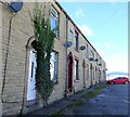
Wild Street, Shaw
A row of terraced houses on an unmade road at the edge of Shaw's commercial/industrial area.
Image: © michael ely Taken: 25 Sep 2020
0.08 miles
3
Houses at Clough, Shaw
Attractive stone houses on the edge of Shaw and near some surviving former cotton mills. This grouping contains two Grade II Listed buildings.
Image: © Chris Allen Taken: 6 Feb 2023
0.08 miles
4
Clough, Shaw
New executive housing on Millbrook Close in the foreground. View south from public footpath looking towards Sholver.
Image: © michael ely Taken: 23 Oct 2006
0.09 miles
5
Shaw Cricket Club
The clubhouse and ground, Shaw Cricket Club.
Image: © Keith Williamson Taken: 1 Dec 2005
0.15 miles
6
Grains Road Shaw
The stone wall in the foreground is where the River Beal runs. JD Williams is a mail order distributor, one of two major ones in Shaw using old mill premises. From this viewpoint Grains Road climbs up to a junction with Buckstones Road.
Image: © michael ely Taken: 25 Feb 2010
0.15 miles
7
Shaw and Crompton station October 2009
Work has just begun on the works to convert the Oldham Loop from a railway to the Metrolink tram system. Looking north from the footbridge that crossed the now defunct level crossing.
Image: © michael ely Taken: 19 Oct 2009
0.17 miles
8
Shaw Cricket Club - Pavilion
The new pavilion at Shaw Cricket Club's Mark Lane ground. Shaw play in the Saddleworth & District League. A Shaw 2nd XI batsman has just been dismissed against Bamford-Fieldhouse 2nd XI.
Image: © BatAndBall Taken: 14 Aug 2010
0.17 miles
9
Ash Mill, Jubilee Street Shaw
Built in 1883 at a cost of £20,000. Demolished 1985. Site now built on as part of huge littlewoods distribution centre that encompasses the site of the former Dee Mill and includes the surviving Lily Nos. 1 & 2.
Image: © Chris Allen Taken: 19 Aug 1984
0.17 miles
10
Fish and Chip Shop, Beal Lane, Shaw
Yum, yum.
Image: © michael ely Taken: 23 Oct 2006
0.17 miles
  • ...