
IMAGES TAKEN NEAR TO
Buckley Street, OLDHAM, OL2 8EZ
Introduction
This page details the photographs taken nearby to Buckley Street, OL2 8EZ by members of the Geograph project.
The Geograph project started in 2005 with the aim of publishing, organising and preserving representative images for every square kilometre of Great Britain, Ireland and the Isle of Man.

There are currently over 7.5m images from over14,400 individuals and you can help contribute to the project by visiting https://www.geograph.org.uk
Image Map
Images are licensed for reuse under creativecommons.org/licenses/by-sa/2.0
Notes
- Clicking on the map will re-center to the selected point.
- The higher the marker number, the further away the image location is from the centre of the postcode.
Image Listing (120 Images Found)
Images are licensed for reuse under creativecommons.org/licenses/by-sa/2.0
Image
Details
Distance
1
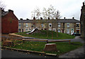
Children's play area, Shaw
Situated between Duckworth Street and Gordon Street (off Oak Street). The terraced houses in the background are on Gordon Street.
Image: © michael ely
Taken: 5 Nov 2010
0.00 miles
2
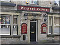
Weavers Answer
Pub on Milnrow Road, Shaw. It used to be called the Railway Hotel.
Image: © michael ely
Taken: 2 Apr 2009
0.03 miles
3
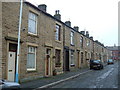
Terraced housing, Shaw
This is a typical terraced street scene in the centre of Shaw. They were built with stone front and stock brick rear elevations for the local cotton mill workers. This is Duckworth St, one of many similar streets in the town centre catering for the first time buyer and rental markets.
Image: © michael ely
Taken: 22 Nov 2005
0.04 miles
4
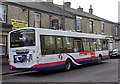
Bus on Milnrow Road, Shaw
At the bus stop outside the Weavers Answer pub.
Image: © michael ely
Taken: 2 Apr 2009
0.05 miles
5
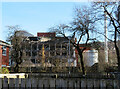
Demolition of Lily No. 1 Mill, Shaw
Built 1904 for cotton spinning and later converted as part of a huge Littlewoods distribution centre. The adjoining No. 2 Mill has already gone and this is well on its way down.
Image: © Chris Allen
Taken: 6 Feb 2023
0.09 miles
6
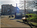
Demolition of Lily No. 1 Mill, Shaw
The two Lily Mills were built as cotton spinning mills and later became part of a huge Littlewoods distribution centre. As far as I can ascertain this is the No. 1 mill that was built in 1904 and was powered by 1200 horsepower Buckley and Taylor inverted vertical engine. No. 2 Mill was built in 1917 and has already gone.
Image: © Chris Allen
Taken: 6 Feb 2023
0.09 miles
7
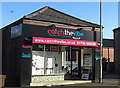
Shaw's new fitness centre
A new addition to the town's service sector. These premises have seen many uses over the years. I first remember them as Taylor's Bike Shop about forty years ago. They are situated at the corner of Milnrow Road and Chandos Street.
Image: © michael ely
Taken: 30 Jan 2010
0.10 miles
8
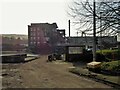
Demolition of Lily Mill
The last part of the mill to be demolished which latterly formed the Shaw national distribution centre for Littlewoods/Very
Image: © Kevin Waterhouse
Taken: 9 Feb 2023
0.10 miles
10
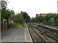
End Of The Line
In the distance, a diesel unit awaits its next turn of duty to Wigan via Manchester in the siding north of Shaw station, while my train is signalled onto the single line to Rochdale. Together with all the Oldham line stations, Shaw will close for good on October 3rd, 2009.
Image: © Peter Whatley
Taken: 16 Sep 2009
0.11 miles