
IMAGES TAKEN NEAR TO
Trent Road, OLDHAM, OL2 7YL
Introduction
This page details the photographs taken nearby to Trent Road, OL2 7YL by members of the Geograph project.
The Geograph project started in 2005 with the aim of publishing, organising and preserving representative images for every square kilometre of Great Britain, Ireland and the Isle of Man.

There are currently over 7.5m images from over14,400 individuals and you can help contribute to the project by visiting https://www.geograph.org.uk
Image Map
Images are licensed for reuse under creativecommons.org/licenses/by-sa/2.0
Notes
- Clicking on the map will re-center to the selected point.
- The higher the marker number, the further away the image location is from the centre of the postcode.
Image Listing (17 Images Found)
Images are licensed for reuse under creativecommons.org/licenses/by-sa/2.0
Image
Details
Distance
1
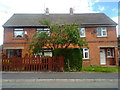
50 & 52 Trent Road, Shaw and Crompton
Numbers 50 & 52 Trent Road, semi-detached properties in the Rushcroft area of Shaw and Crompton, in Greater Manchester, England.
Image: © Steven Haslington
Taken: 9 Jun 2011
0.01 miles
4

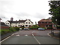
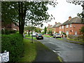
Christmas Day in the woods near Shaw
Small nature Park off Valley Rise, Rushcroft, Shaw.
Image: © michael ely
Taken: 25 Dec 2005
0.10 miles
5
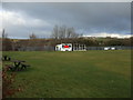
Crompton Cricket Club - Scoreboard
The scoreboard at Crompton CC. The club run two teams in the Central Lancashire League.
Image: © BatAndBall
Taken: 10 Dec 2012
0.15 miles
6
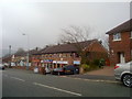
Row of shops on Duchess Street , Shaw
Across the road is a row of shops on Duchess Street, in the Rushcroft area of Shaw and Crompton, Greater Manchester.
Image: © Steven Haslington
Taken: 17 Mar 2011
0.16 miles
7

Woodland walk, Higher Rushcroft
An attractive woodland amenity area on land between Trent Road and Valley Rise.
Image: © michael ely
Taken: 30 Jan 2010
0.16 miles
8

Hurricane Katia hits Shaw
Katia brought a perfect drying day today. The tailend of this mighty hurricane, that caused such devastation on USA's eastern seaboard, is now only a blustery reminder of nature's raw power.
Image: © michael ely
Taken: 13 Sep 2011
0.18 miles
9
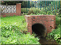
Pencil Brook, Rushcroft, Shaw
Pencil Brook is culverted underground for much of its length with the houses of Lower and Higher Rushcroft being built above it. Here it emerges near Rushcroft primary school after starting its subterranean journey at Moss Gate.
Image: © michael ely
Taken: 14 Sep 2011
0.18 miles
10
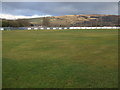
Crompton Cricket Club - Ground
Looking across Crompton CC's Glebe Street ground towards Saddleworth.
Image: © BatAndBall
Taken: 10 Dec 2012
0.20 miles