IMAGES TAKEN NEAR TO
South Downs Close, OLDHAM, OL2 7RG
Introduction
This page details the photographs taken nearby to South Downs Close, OL2 7RG by members of the Geograph project.
The Geograph project started in 2005 with the aim of publishing, organising and preserving representative images for every square kilometre of Great Britain, Ireland and the Isle of Man.

There are currently over 7.5m images from over14,400 individuals and you can help contribute to the project by visiting https://www.geograph.org.uk
Image Map
Images are licensed for reuse under creativecommons.org/licenses/by-sa/2.0
Notes
- Clicking on the map will re-center to the selected point.
- The higher the marker number, the further away the image location is from the centre of the postcode.
Image Listing (60 Images Found)
Images are licensed for reuse under creativecommons.org/licenses/by-sa/2.0
Image
Details
Distance
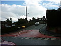
1

Post-mounted postbox
By the junction of Long Rushes and Trent Road, Higher Rushcroft, Shaw.
Image: © michael ely
Taken: 26 Jan 2013
0.01 miles
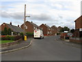
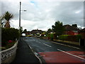
2
North Downs Road, High Crompton
Looking towards the Grampian Way/Trent Road junction. Crompton Moor can be seen in the far distance.
Image: © michael ely
Taken: 6 Dec 2010
0.05 miles
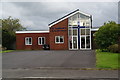
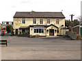
6
Crompton - The North Star Public House
Image: © Peter Whatley
Taken: 5 Oct 2009
0.11 miles
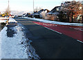
7
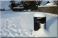
Litter bin at Higher Rushcroft
A snowy scene on Long Rushes by the corner of Rush Mount.
Image: © michael ely
Taken: 26 Jan 2013
0.13 miles
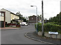
8
North Star
Rushcroft Road, High Crompton.
Image: © David Dixon
Taken: 17 Mar 2010
0.13 miles