
IMAGES TAKEN NEAR TO
Tandle Hill Road, OLDHAM, OL2 5UU
Introduction
This page details the photographs taken nearby to Tandle Hill Road, OL2 5UU by members of the Geograph project.
The Geograph project started in 2005 with the aim of publishing, organising and preserving representative images for every square kilometre of Great Britain, Ireland and the Isle of Man.

There are currently over 7.5m images from over14,400 individuals and you can help contribute to the project by visiting https://www.geograph.org.uk
Image Map
Images are licensed for reuse under creativecommons.org/licenses/by-sa/2.0
Notes
- Clicking on the map will re-center to the selected point.
- The higher the marker number, the further away the image location is from the centre of the postcode.
Image Listing (30 Images Found)
Images are licensed for reuse under creativecommons.org/licenses/by-sa/2.0
Image
Details
Distance
1
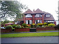
Tandle Hill Road, Royton
Executive looking semi-detached houses on Tandle Hill Road in Thornham, a suburban area of Royton, in Greater Manchester, England.
Image: © Steven Haslington
Taken: 6 Jun 2011
0.00 miles
2

Hanging Chadder
View looking towards Hanging Chadder seen from Tindle Hill.
Image: © Peter McDermott
Taken: 13 Nov 2021
0.03 miles
5
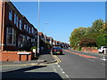
Rochdale Road
Looking north west on the A671.
Image: © JThomas
Taken: 10 Oct 2018
0.06 miles

7
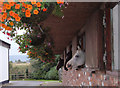
Stables at High Gate Farm, Summit
The line of the Oldham Way passes through the farmyard between Gravel Hole and Tandle Hill.
Image: © michael ely
Taken: 16 Sep 2007
0.08 miles
9
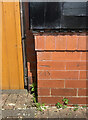
OS Cut Mark - Royton, #30 Tandle Hill Road
https://www.bench-marks.org.uk/bm133984
Image: © thejackrustles
Taken: 18 Jul 2022
0.10 miles
10
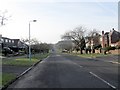
Tandle Hill Road
An arrow straight avenue leading to the park.
Image: © Peter Whatley
Taken: 21 Jan 2010
0.10 miles