IMAGES TAKEN NEAR TO
Delamere Road, ROCHDALE, OL16 4XN
Introduction
This page details the photographs taken nearby to Delamere Road, OL16 4XN by members of the Geograph project.
The Geograph project started in 2005 with the aim of publishing, organising and preserving representative images for every square kilometre of Great Britain, Ireland and the Isle of Man.

There are currently over 7.5m images from over14,400 individuals and you can help contribute to the project by visiting https://www.geograph.org.uk
Image Map (Loading...)


Getting Data...Please wait
Leaflet Map data © OpenStreetMap
Images are licensed for reuse under creativecommons.org/licenses/by-sa/2.0
Notes
- Clicking on the map will re-center to the selected point.
- The higher the marker number, the further away the image location is from the centre of the postcode.
Image Listing (12 Images Found)
Images are licensed for reuse under creativecommons.org/licenses/by-sa/2.0
Image
Details
Distance
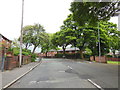
2
Turf Hill Road, Rochdale
Social and/or ex-social housing on Turf Hill Road, in the Turf Hill area of Rochdale, Greater Manchester. Turf Hill is occupied by Turf Hill Estate, a purpose-built social housing area.
Image: © Steven Haslington
Taken: 23 Jun 2011
0.09 miles
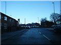
4
Road Kingsway Business Park
Looking north west from Lower Lane
Image: © Alexander P Kapp
Taken: 27 May 2010
0.17 miles
5
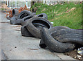
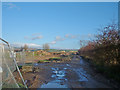
Fly Tipping on Lower Lane
At the road closure point at the boundary of the Rochdale Kingsway Business Park.
Image: © michael ely
Taken: 5 Apr 2008
0.19 miles
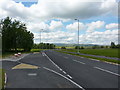
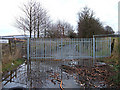
6
End of the road
This is the end of Lower Lane, beyond is the developing Kingsway Business Park. Lower Lane use to continue on to Buckley Hill Lane and then on to Rochdale Road
Image: © Alexander P Kapp
Taken: 27 May 2010
0.20 miles
7
Lower Lane
The road is still closed for the Rochdale Kingsway Business Park development. Its closure appears more permanent than it did 14 months ago in November 2006. See here Image
Image: © michael ely
Taken: 19 Jan 2008
0.21 miles
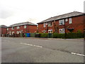
8
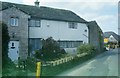
Tithe Barn Farm
Situated on Lower Lane on the edge of the Kingsway Business Park, this old farm is surrounded by modern houses.
Image: © Bryan Tenny
Taken: Unknown
0.22 miles
9
Goodbye Lower Lane
This used to be a quiet lane through farmland linking the Milnrow and Balderstone areas of Rochdale. It is now closed to make way for the Rochdale Kingsway 170 hectares Business Park development that is underway. The photograph is taken from the point of closure near Lower Place.
Image: © michael ely
Taken: 28 Nov 2006
0.22 miles
10
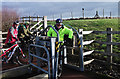
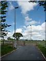
Negotiating a sqeeze stile
The Kingsway Business park development has had a network of bridleways incorporated into the project to provide cyclists and other users with a traffic-free environment. These squeeze stiles are designed to slow bicycles at points where they cross roads.
Image: © michael ely
Taken: 30 Jan 2013
0.22 miles