IMAGES TAKEN NEAR TO
Huddersfield Road, ROCHDALE, OL16 3TG
Introduction
This page details the photographs taken nearby to Huddersfield Road, OL16 3TG by members of the Geograph project.
The Geograph project started in 2005 with the aim of publishing, organising and preserving representative images for every square kilometre of Great Britain, Ireland and the Isle of Man.

There are currently over 7.5m images from over14,400 individuals and you can help contribute to the project by visiting https://www.geograph.org.uk
Image Map
Images are licensed for reuse under creativecommons.org/licenses/by-sa/2.0
Notes
- Clicking on the map will re-center to the selected point.
- The higher the marker number, the further away the image location is from the centre of the postcode.
Image Listing (27 Images Found)
Images are licensed for reuse under creativecommons.org/licenses/by-sa/2.0
Image
Details
Distance
1
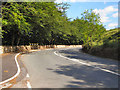
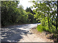
Huddersfield Road (A640)
In the direction of Denshaw.
Image: © David Dixon
Taken: 16 Jun 2010
0.06 miles
2
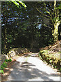
Path To Lower Ogden
From Huddersfield Road.
Image: © David Dixon
Taken: 16 Jun 2010
0.07 miles
3
Huddersfield Road (A640)
Looking in the direction of Newhey.
Image: © David Dixon
Taken: 16 Jun 2010
0.11 miles
4
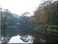
Wickenhall Trout Pond near Ogden, Newhey
There are two adjacent private trout ponds at this location. This is the lower one in a secluded spot below the A640 Huddersfield Road.
Image: © michael ely
Taken: 21 Nov 2005
0.12 miles
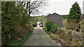
6
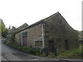
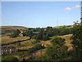
Lane to Higher Ogden
This steep lane climbs from Lane Bottom to a cluster of cottages at Higher Ogden. The buildings in view were, many years ago, a restaurant called The Shippon.
Image: © michael ely
Taken: 1 Mar 2010
0.15 miles
7
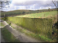
Stone flag wall
An interesting wall made of up-ended stone slabs.
Image: © John Illingworth
Taken: 6 Feb 2008
0.15 miles
8
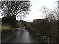
Cobbled Road at Pioneer Villas
At Lanebottom the hamlet where there was a very successful Lanebottom Industrial Equitable Pioneers Society (a Co-op)
Image: © Kevin Waterhouse
Taken: 10 Apr 2022
0.15 miles