IMAGES TAKEN NEAR TO
Huddersfield Road, ROCHDALE, OL16 3TA
Introduction
This page details the photographs taken nearby to Huddersfield Road, OL16 3TA by members of the Geograph project.
The Geograph project started in 2005 with the aim of publishing, organising and preserving representative images for every square kilometre of Great Britain, Ireland and the Isle of Man.

There are currently over 7.5m images from over14,400 individuals and you can help contribute to the project by visiting https://www.geograph.org.uk
Image Map (Loading...)


Getting Data...Please wait
Leaflet Map data © OpenStreetMap
Images are licensed for reuse under creativecommons.org/licenses/by-sa/2.0
Notes
- Clicking on the map will re-center to the selected point.
- The higher the marker number, the further away the image location is from the centre of the postcode.
Image Listing (45 Images Found)
Images are licensed for reuse under creativecommons.org/licenses/by-sa/2.0
Image
Details
Distance
3
Newhey
Recreating this 'First' for the square https://www.geograph.org.uk/photo/41761 .
Image: © Alan Murray-Rust
Taken: 1 Oct 2023
0.01 miles
4

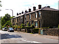
Houses on the A640, Newhey
Taken from the public footpath along the steep-sided ridge north of the road.
Image: © Humphrey Bolton
Taken: 20 Apr 2011
0.03 miles
5
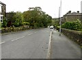
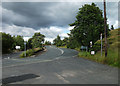
Huddersfield Road, Newhey
A small sign stating only "Newhey" is the only marker drawing one's attention to the entrance to the suburban village of Newhey in the Metropolitan Borough of Rochdale, Greater Manchester, England. This photograph was taken along Huddersfield Road in Ogden.
Image: © Steven Haslington
Taken: 15 May 2012
0.04 miles
6
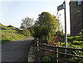
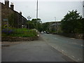
Bethany Lane, Newhey
This is at the junction with Huddersfield Road. Bethany Lane is a bridleway that is a quiet back road to The Haugh.
Image: © michael ely
Taken: 15 May 2010
0.04 miles
7
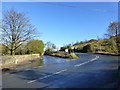
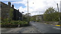
Junction of Ogden Road and Huddersfield Road
Image: © Raymond Knapman
Taken: 4 Nov 2013
0.04 miles
8
View from N end of Bethany Lane
Bethany Lane is a surfaced bridleway that runs from The Haugh to the junction with the A640, Huddersfield Road.
Image: © michael ely
Taken: 9 Aug 2011
0.04 miles

10

Weirs on Piethorne Brook, Newhey
These are downstream of the dyeworks, and might have provided a water supply for Wood Mill, long since demolished.
Image: © Humphrey Bolton
Taken: 20 Apr 2011
0.04 miles